Logo Turismo Granada Header

Lakes and Peaks of Sierra Nevada

A 5-day-long circular itinerary that permits the visiting of the most representative lakes of the mountain range, as well as the ascent of its principal peaks.

Downloads

Alta Montaña

High Mountain

Trekking

Summer Trekking

Verano

Summer

Technical data sheet

Need for authorization / notification: Yes.

Yes, for camping at night. Via e-mail: pnsierranevada.usopublico.dtgr.capds@juntadeandalucia.es

Technical Difficulty:

Very demanding excursion. Very significant elevation gain and distance, delicate passes and possible snow (F, 45º).

Time with stops: 07:00 h.
Details on the duration:

The time with short stops is approximately 7:00 hours a day.

The no-stop time is approximately 20 hours and a quarter.

Distance: 57,50 Km.
Positive height gain accumulated: 4.230,00 m.
Negative height gain accumulated: 4.230,00 m.
Minimum altitude: 2,508 out,00 m.
Maximum altitude: 3.478,00 m.
Departure point: Hoya de la Mora, Sierra Nevada (Monachil).
Point of arrival: Hoya de la Mora, Sierra Nevada (Monachil).
Water points: Yes.
List of water points:

Along the route we will find enough water springs and streams. The water is not very mineralized, so it is recommended to make up for this deficiency by eating regularly during the route. As for the potability of the water, it is very unlikely that the high mountain water is "contaminated", however, it is recommended to use water purification tablets in case of lack of habit or doubt (in case of stagnant water). All of the proposed overnight sites have water in the vicinity. The points most likely to have water are the following:

  • Day 1: Barranco de San Juan (point 1), Corral del Veleta (between points 3 and 4), drainage of the Laguna de la Gabata (point 6), and the spring next to the Laguna de la Mosca (point 7).
  • Day 2: Spring next to and above the Laguna de la Mosca (point 7) and springs next to and above the Laguna Hondera (point 18).
  • Day 3: Springs next to and above the Laguna Hondera (point 18), drainage of the Laguna de Río Seco (point 23), and drainage of the Laguna de Aguas Verdes (point 27).
  • Day 4: Drainage of the Laguna de Aguas Verdes (point 27), Lanjarón River (drainage of the Laguna de Lanjarón (point 33) and Laguna del Caballo (point 39).
  • Day 5: Laguna del Caballo (point 39) and Lagunillos de la Virgen (point 45).
Closest/s Population/s : Pradollano, Capileira, Trevelez, Lanjarón, and Nigüelas.
Municipality/ies: Monachil, Güejar Sierra, Trevélez, Capileira, Lanjarón, Nigüelas, Dúrcal and Dilar.
Region/s: Vega de Granada, Alpujarra of Granada, and the Valle de Lecrín.
Natural Space/s: Natural park of Sierra Nevada - Las Alpujarras

Map & Profile

Map "Lakes and Peaks of Sierra Nevada"
Profile of the route "Lakes and Peaks of Sierra Nevada"

Waypoints

Point Name Time (*) Height Latitude (**) Length (**)
0 Hoya de la Mora 0:00 h. (day 1) 2.505 m. N37° 05' 42.9" W3° 23' 06.9"
1 Barranco de San Juan 0:30 h. (day 1) 2.574 m. N37° 05' 03.2" W3° 22' 18.8"
2 Veredón Inferior (beginning) 1:25 pm. (day 1) 2.982 m. N37° 04' 19.4" W3° 21' 56.6"
3 Veredón Inferior (end) 1:40 pm. (day 1) 2.960 m. N37° 04' 05.0" W3° 21' 59.4"
4 Collado Veta Grande 3:30 pm. (day 1) 2.961 m. N37° 04' 04.2" W3° 20' 57.9"
5 Lagunillos of Valdeinfierno 4:20 pm. (day 1) 2.871 m. N37° 03' 34.1" W3° 20' 42.0"
6 Lagunillo of the Gabata and Laguna Larga 5:20 pm. (day 1) 2.794 m. N37° 03' 39.5" W3° 20' 04.1"
7 Laguna de la Mosca (or Mulhacén) 7:00 pm. (day 1) 2.901 m. N37° 03' 39.5" W3° 18' 50.8"
7 Laguna de la Mosca (or Mulhacén) 0:00 h. (day 2) 2.901 m. N37° 03' 39.5" W3° 18' 50.8"
8 Gran Vasar de la Alcazaba (beginning) 0:20 h. (day 2) 2,950 m. N37° 03' 52.6" W3° 18' 27.4"
9 Espolón de la Alcazaba 0:50 h. (day 2) (3,000 m). N37° 04' 17.2" W3° 18' 14.8"
10 Collado del Goterón 1:30 pm. (day 2) 3.038 m. N37° 04' 25.2"


W3° 17' 41.6"
11 Tajos del Goterón (beginning) 1:50 pm. (day 2) 3,100 m. N37° 04' 20.7" W3° 17' 50.8"
13 Tajos del Goterón (end) 2:30 h. (day 2) 2.981 m. N37° 04' 05.8" W3° 17' 29.9"
14 Paso de la Z (start) 3:10 h. (day 2) 2.982 m. N37° 03' 56.0" W3° 17' 24.3"
15 Paso de la Z (end) 3:30 pm. (day 2) In 3,070 m. N37° 03' 52.7" W3° 17' 28.8"
16 Alcazaba 4:15 h. (day 2) 3.371 m. N37° 04' 08.4" W3° 18' 01.5"
17 The Colaero 5:15 h. (day 2) 3.261 m. N37° 03' 47.5" W3° 18' 03.5"
18 Laguna Hondera (Siete Lagunas) 6:00 pm. (day 2) Remaining 2,897 roma m. N37° 02' 55.5" W3° 17' 37.3"
18 Laguna Hondera (Siete Lagunas) 0:00 h. (day 3) Remaining 2,897 roma m. N37° 02' 55.5" W3° 17' 37.3"
19 Mulhacén 1:45 h. (day 3) 3.478 m. N37° 03' 16.4" W3° 18' 37.6"
20 Refuge of la Caldera 3:15 h. (day 3) 3.057 m. N37° 03' 21.6" W3° 19' 31.3"
21 Laguna de la Caldera -- 3.024 m. N37° 03' 20.2" W3° 19' 37.7"
22 Loma Pelá 4:15 h. (day 3) 3.156 m. N37° 03' 19.2" W3° 19' 54.9"
23 Laguna de Río Seco -- 3.026 m. N37° 03' 12.4" W3° 20' 42.2"
24 Climb to Los Machos (beginning) 5:15 h. (day 3) 3.125 m. N37° 03' 11.2" W3° 21' 36.5"
25 Los Machos 5:45 pm. (day 3) 3.327 m. N37° 03' 30.4" W3° 21' 22.9"
26 Los Machos 5:50 pm. (day 3) 3.133 m. N37° 03' 14.3" W3° 21' 49.0"
24 Climb to Los Machos (end) 6:10 h. (day 3) 3.125 m. N37° 03' 11.2" W3° 21' 36.5"
26 Los Machos 6:15 h. (day 3) 3.133 m. N37° 03' 14.3" W3° 21' 49.0"
27 Laguna Aguas Verdes 6:30 pm. (day 3) 3.066 m. N37° 03' 00.3" W3° 22' 01.4"
27 Laguna Aguas Verdes 0:00 h. (day 4) 3.066 m. N37° 03' 00.3" W3° 22' 01.4"
28 La Carihuela bivouac shelter 0:30 h. (day 4) 3.205 m. N37° 03' 03.1" W3° 22' 11.9"
29 Veleta 1:00 pm. (day 4) 3.398 m. N37° 03' 26.1" W3° 21' 52.5"
28 La Carihuela bivouac shelter 1:40 pm. (day 4) 3.205 m. N37° 03' 03.1" W3° 22' 11.9"
30 Tajos de la Virgen 2:10 h. (day 4) For 3,240 m. N37° 02' 54.5" W3° 22' 31.7"
31 Tajos del Nevero 2:40 pm. (day 4) 3.198 m. N37° 02' 40.3" W3° 22' 53.3"
32 Shelter Elorrieta (in bad condition) 3:10 h. (day 4) 3.187 m. N37° 02' 31.7" W3° 23' 27.9"
33 Laguna de Lanjarón -- 2.980 m. N37° 02' 19.5" W3° 23' 59.1"
34 Lagunillo de Charca Pala 4:15 h. (day 4) 2,932 in m. N37° 02' 13.2" W3° 24' 13.3"
35 Charcas de Tajos Altos 4:50 pm. (day 4) 2.953 m. N37° 02' 01.3" W3° 24' 32.5"
36 Laguna de Tajos Altos 5:00 pm. (day 4) 2.904 m. N37° 01' 53.0" W3° 24' 36.6"
37 Laguna Cuadrada 5:20 pm. (day 4) 2,892 responses m. N37° 01' 40.7" W3° 25' 01.4"
38 Laguna de Nájera -- 2.734 m. N37° 01' 05.7" W3° 25' 48.1"
39 Laguna del Caballo 6:30 pm. (day 4) 2.848 m. N37° 00' 57.8" W3° 26' 10.2"
39 Laguna del Caballo 0:00 h. (day 5) 2.844 m. N37° 00' 57.8" W3° 26' 10.2"
40 Refugio-vivac del Caballo 0:02 h. (day 5) 2.848 m. N37° 00' 55.6" W3° 26' 09.0"
41 Refuge of Lanjarón 0:25 h. (day 5) 2.815 m. N37° 00' 28.9" W3° 26' 25.6"
42 Caballo 0:50 h. (day 5) 3.011 m. N37° 00' 47.4" W3° 26' 18.9"
43 Tajos Altos 2:50 pm. (day 5) 3.111 m. N37° 01' 55.7" W3° 24' 47.2"
44 Tozal del Cartujo 4:05 h. (day 5) 3.152 m. N37° 02' 27.0" W3° 24' 13.4"
32 Shelter Elorrieta (in bad condition) 4:50 pm. (day 5) 3.187 m. N37° 02' 31.7" W3° 23' 27.9"
45 Lagunillos de la Virgen 5:35 h. (day 5) 2.944 m. N37° 03' 12.3" W3° 22' 40.3"
46 Las Yeguas Reservoir 6:00 pm. (day 5) 2.885 m. N37° 03' 29.1" W3° 22' 42.8"
47 Borreguiles 6:20 pm. (day 5) 2.760 m. N37° 04' 08.5" W3° 22' 58.9"
0 Hoya de la Mora 7:00 pm. (day 5) 2.505 m. N37° 05' 42.9" W3° 23' 06.9"

(*) Approximate times counting stops.
(**) Geographic coordinates. European Datum 1950.

Cover-Video-Lagunas-y-Cumbres
Play Video

Introduction

The layout of this route is the brainchild of Francisco Ruiz Arroyo. 

This is a 5-day circular itinerary that allows you to visit the most representative lakes of Sierra Nevada, as well as to ascend to its main summits. The route begins and ends in the Hoya de la Mora and runs at all times close to the 3,000 m elevation. During the first 3 days the itinerary revolves around the Mulhacén and the Alcazaba, "the giants" of the Sierra, passing under its abrupt north faces and ascending to its summits. In this first part we spend the night in two of the most beautiful and unique places of the sierra: the Hoya del Mulhacén (where the Laguna de la Mosca is located) and the Cañada de Siete Lagunas. During the last 2 days the route allows the ascent to the Veleta and crosses the most technical section of the entire proposed itinerary, the Tajos de la Virgen. In this second part of the journey, the most representative lakes and the peaks with a minimum of 3000 meters of height of the remote Lanjarón Valley are crossed.

The relief of the high mountains of the Sierra Nevada is the result of the modeling process exerted by glaciers during the Quaternary. The glaciers eroded the rock and transported down the generated debris. In the highest areas, under the summits, are the cirques, which have very large basins that are the result of overexcavation by glaciers, and which house most of the lagoons. Downwards, there are U-shaped valleys, where the glacier tongues once flowed.

Between 30 and 40% of the existing flora on the summits of the Sierra Nevada is considered exclusive to the massif. There are some 80 endemic plant species. The Estrella de las Nieves, emblem of the National Park, is one of these species.

Description

DURATION:

The complete itinerary requires 5 days, however, it can be divided into 2 non-consecutive routes. Thus, we can do the first 3 days returning on the third day to Hoya de la Mora (point 0) from the Refugio-vivac La Carihuela (point 28), without staying overnight at the Laguna de Aguas Verdes (point 27), or do the last 2 days going up to the Refugio-vivac La Carihuela from Hoya de la Mora on the first day. The journey from the Refugio-vivac La Carihuela to Hoya de la Mora takes approximately 1:15 h., and the reverse journey takes 2:30 h.

DIFFICULTY:

Very high. This is a very demanding excursion, with 4,230 m. of positive vertical drop and a distance of 57.50 km. The completion of the route requires 5 days (4 nights), which entails the carrying of large backpacks, weighing 15-20 kg. In the itinerary there are slopes with gradients close to 45%. There are also exposed sections, although avoidable, of up to II degree of rock climbing (steps and climbs with good grips in which the hands are used to maintain balance and progress). Until late summer there are snowdrifts (snow accumulations) in Sierra Nevada, which may make it necessary to have crampons and ice axes, and to know how to use them. Helmets must be worn when crossing the Veredón Inferior. (during the 1rst first day), tthe Gran Vasar de La Alcazaba and the Tajos del Goterón (during the 2nd day), as well as the Tajos de La Virgen and in the chain pass of Verea Cortá (during the 4th day), since in these places we could suffer the fall of stones. Lacking vertigo and having members of the group who know how to orient themselves on terrain with no apparent trace is essential. We should not overestimate our abilities. In case of doubt or insufficient experience, please ask a mountain guide.

M. I. D. E. Method (tour Information):

MIDE - Lagunas y Cumbres

Assessment of aspects 1 to 5.

MATERIAL NEEDED:

Mountain boots (semi-rigid recommended if you are going to crampon), warm clothing (hat, gloves, fleece, down jacket or similar...), waterproof jacket, cap or similar, neck tube, sunglasses, high protection sunscreen, walking sticks, head flashlight, knife, lighter, map and compass and/or GPS (with spare charge), cell phone, first aid kit, large backpack (70-80 l. ), water (1.5-2 l.), food for 5 days, kitchen utensils (stove, gas cartridge, saucepan, glass, plate, cutlery and others), spare T-shirts, underwear and socks, mat, sleeping bag (comfort temperature depending on the season, minimum -2ºC), bivouac cover or tent and helmet. Until late in the summer we may have to cross snowdrifts, so it will be necessary to have crampons and ice axes, and know how to use them. The use of tents is recommended (bivouacking is subject to authorization if there are more than 15 people or more than 3 tents, or to prior notice if the number of people and tents is less than those indicated). Since only night camping is allowed, the tent must be set up 1 hour before sunset (never on the sheepfolds that surround the lagoons, a very sensitive type of vegetation that is protected) and must be dismantled 1 hour after sunrise. The tent will serve as shelter in case of rain and/or wind (we must not forget that we are in the high mountains and that, even in summer, we can encounter very adverse weather conditions) and will also prevent foxes from taking our provisions (even our footwear) and scattering our garbage around during the night (which we will avoid by keeping everything inside the tent, although sometimes even the latter does not work against the cunning of the fox).

BEST TIME/S:

The best time to take this route is the summer.

MAPPING:

Sierra Nevada National park. The Alpujarra. Marquesado del Zenete. Scale 1:40.000. Editorial Penibética.

LANDSCAPE, FLORA AND FAUNA:

High siliceous summits with glacial and periglacial forms. The predominant type of vegetation is the psicroxerophilous grassland and, at higher altitudes, the vegetation of scree and rocky areas. We will see violets, snapdragons, gentians, poppies, leontodons, erigerones... and, with luck, the Manzanilla Real. Around lakes and watercourses we will find the borreguiles and their associated vegetation, such as the Estrella de las Nieves, symbol of the National Park. It is very common to see mountain goats and, at night, foxes. There are also snow voles, much more elusive, and birds such as the Alpine Accentor.

PEAKS/PORTS:

Nine peaks over 3,000 meters high are climbed: Alcazaba (3,371 masl.), Mulhacén (3,478 masl.), Los Machos (3,327 masl.), Veleta (3,398 masl. ), Tajos de la Virgen (3.240 masl.), Tajos del Nevero (3.198 masl.), Caballo (3.011 masl.), Tajos Altos (3.111 masl.) and Tozal del Cartujo (3.152 masl.). The route goes through the Collado de La Carihuela, a mountain pass that used to facilitate the road communication between La Alpujarra and the capital city of Granada.

MATCHING ALTERNATIVE ACTIVITIES:

Since the route includes a large part of the high snowy mountains, there are many alternative activities (hiking, climbing, mountaineering, etc.) that we could do. Among these activities, we highlight one of a similar nature to the one that concerns us: the "Integral de los Tresmiles".

REMARKS:

In case of need, there are several unguarded shelters (bivouac shelters and old forest shelters) along our route that could get us out of trouble. These shelters are: Refugio-vivac La Caldera (point 20), Refugio-vivac La Carihuela (point 28), Refugio de Elorrieta (point 32) and Refugio-vivac del Caballo (point 40). The Refugio Elorrieta, of a very unique architecture (it has a part excavated in the rock), does not present ideal conditions for habitability, especially if it rains or hails intensely. Something similar happens with the Refugio-vivac del Caballo, which also has leaks. Both shelters date from the 30's of the last century and owe their construction to the reforestation works carried out at that time along the Lanjarón Valley.

RULES TO RESPECT:

Summarized in a brief guide to environmental regulations applied to mountain sports in protected natural spaces of Andalusia (pages 54 and 55) and in the booklets General rules in the Natural area of Sierra Nevada, Responsible behavior in the National Park and Natural Park of Sierra Nevada, and Responsible behavior, Droppings, and debris of personal hygiene. More extended in the Decree 238/2011, 12 July, which establishes the organization and management of Sierra Nevada (points 5.4.5. –p. 163 - and 5.2. –page 262-). In addition, the realization of this activity, as it involves camping, requires prior authorization or notification. Applications can be obtained through the address: pnsierranevada.usopublico.dtgr.capds@juntadeandalucia.es

WEATHER:

ROAD CONDITIONS:

Before starting the route, it is recommended to consult the conditions in which the delicate passages of the route are found through the following links:

How to arrive by car

From Granada we exit through the A-44 in the direction of Motril and take the exit 132 (Ronda Sur/Sierra Nevada/Alhambra/Campus de la Salud/Armilla). Once in Ronda Sur, we take the exit 5B (A-395/Sierra Nevada/Pinos Genil). From here we can only follow the road A-395 without deviating at any time. Arriving at Pradollano (the ski resort), we will find a crossroads where we are indicated the direction to follow towards the "albergues/hoya de la mora". We take this detour (to the left) and follow the signs that lead us to the Hoya de la Mora. Arrived at the Hoya de la Mora (point 0), we will see that there are two paved esplanades and several wooden kiosks on both sides of the road. In one of the two esplanades we will find parking for our vehicle.

Parking

Available.
Parking exit:

Hoya de la Mora, Sierra Nevada (Monachil).

Parking arrival:

Hoya de la Mora, a Sierra Nevada (Monachil)

https://goo.gl/maps/PacH42EewwWSaBPJA

How to get there by public transport

The buses depart from the Bus station in Granada (platform 3) in the direction of Pradollano they do so with the following hours. Once we get to Pradollano we will have to resort to any of the transportation services available to take us to the Hoya de la Mora (point 0) and to be able to start the activity.

At the end of the activity in the Hoya de la Mora, we will have to contact again with the transportation service so they can pick us up and bring us to Pradollano, catching there the bus to Granada which leaves at different hours.

Route

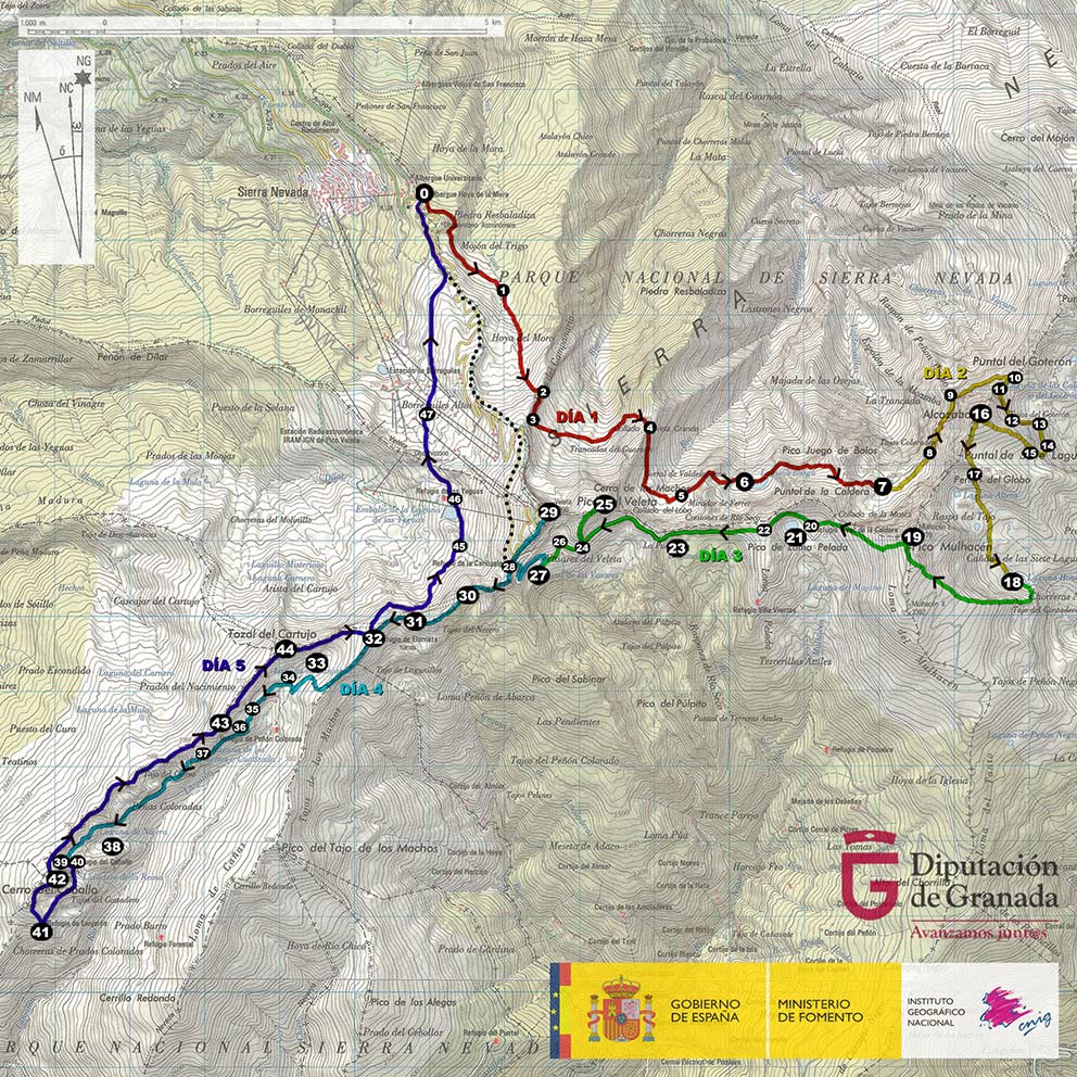
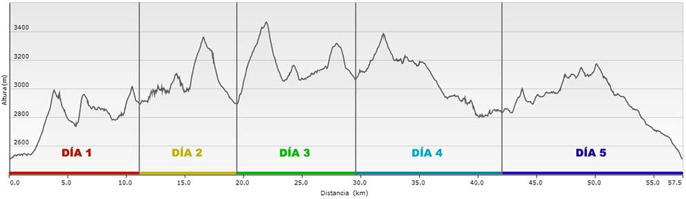
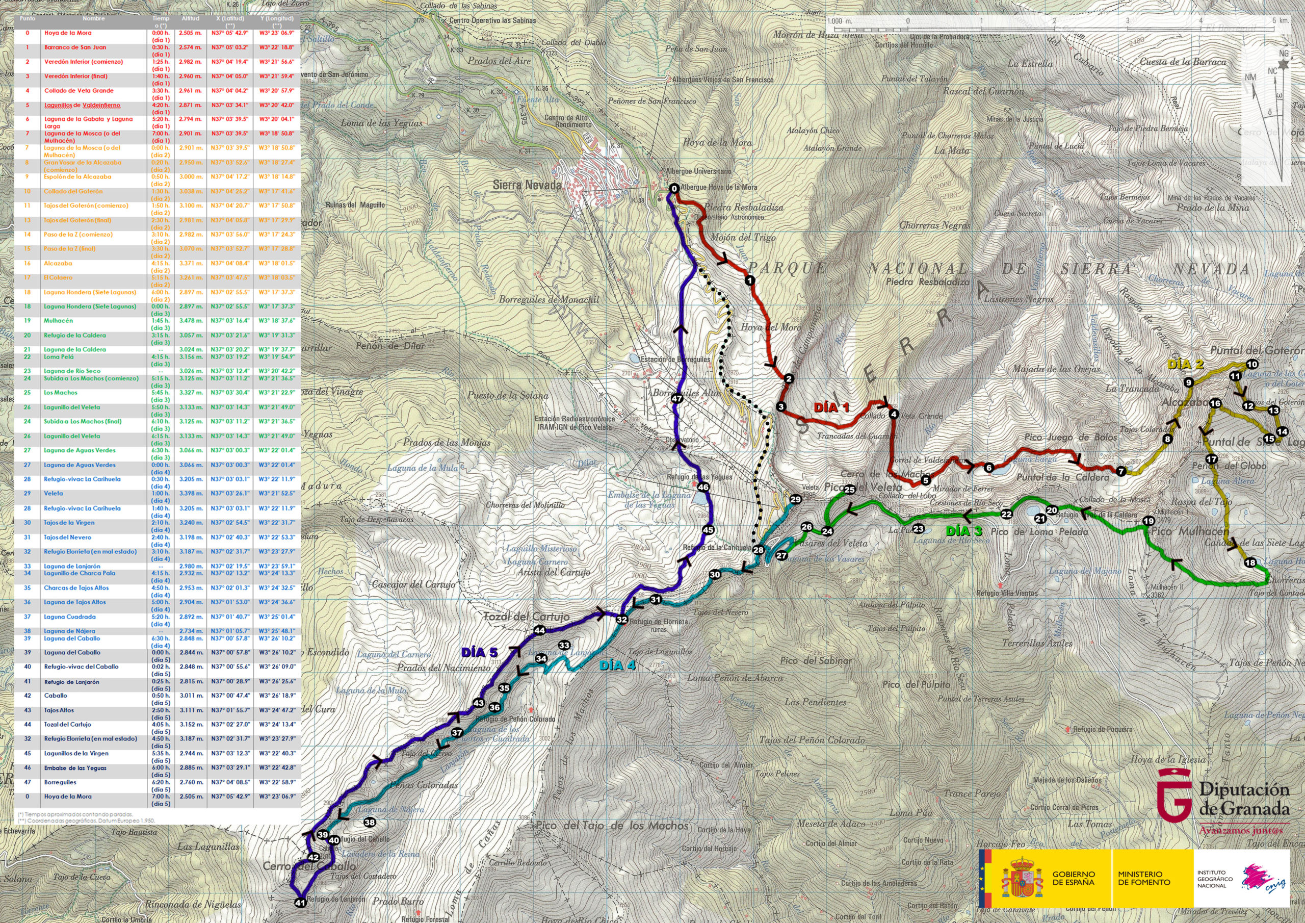
DAY 1: HOYA DE LA MORA – LAGUNA DE LA MOSCA

We start from the Hoya de la Mora (point 0), where we will have parked our vehicle, and, after passing in front of the Capitán Cobo Military Shelter, we will leave the road (crossing the fence located on its left margin) and follow the comfortable path that takes us into the Barranco de San Juan. Above, to our right, we will see the astronomical observatory known as Mojón del Trigo, while below, to our left, in the area known as Campos de Otero, we will see the Albergue de San Francisco, with its characteristic red roof. The Llanos de Campo de Otero, today known as the Campos de Otero, was the place where the pioneers of skiing began to practice this sport in Sierra Nevada, back in the 20s of the last century.

Refugio Militar Gil Cono (a la izquierda) y Albergue de San Francisco (abajo)
Military shelter Gil Cono (left) and Albergue de San Francisco (below)

As we move forward, we'll get closer to the river San Juan (point 1), which we will ford to continue our ascent on the opposite side of it.

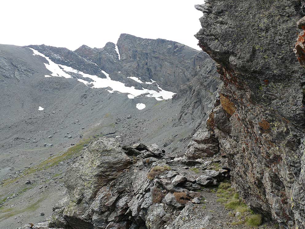
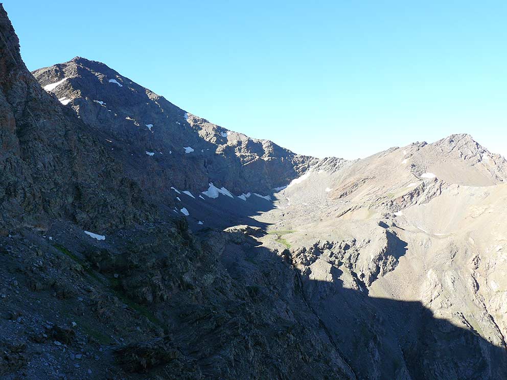
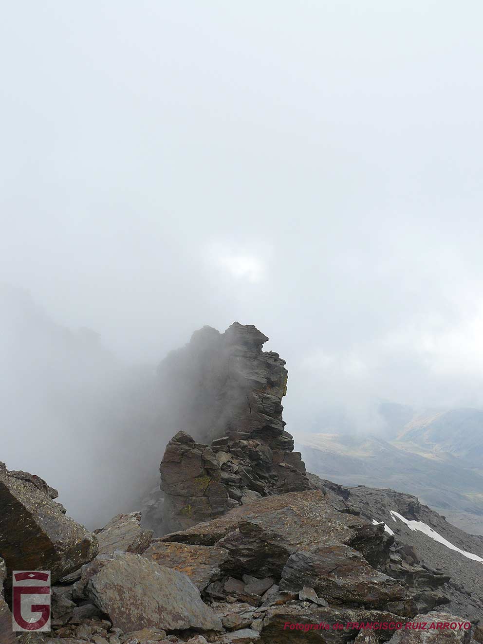
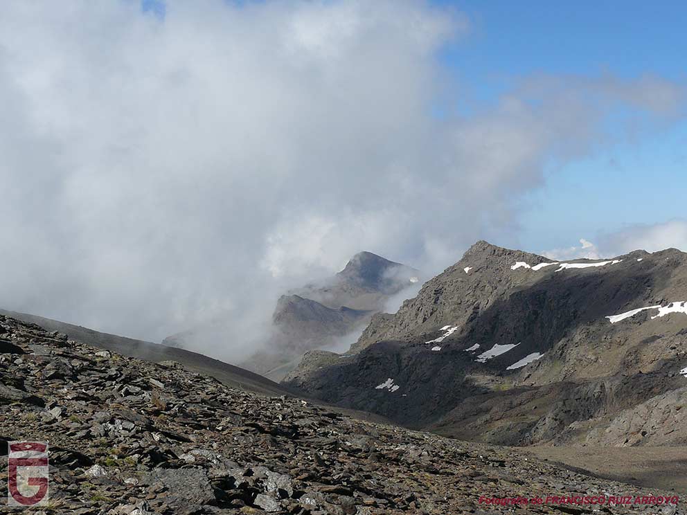
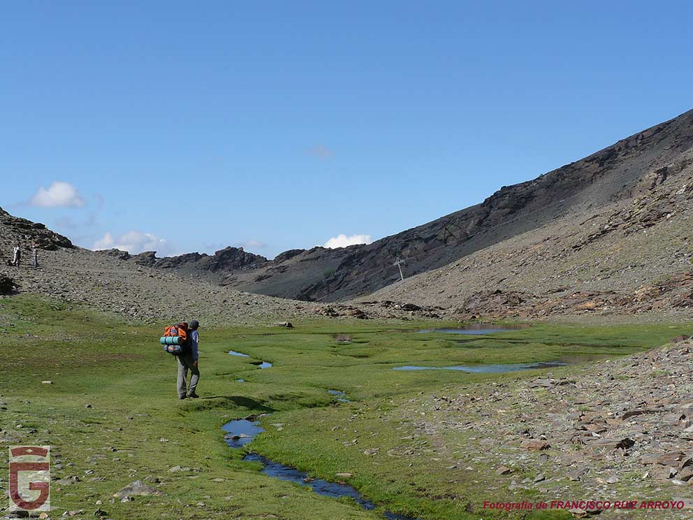
When we find ourselves at the head of the Barranco de San Juan, where the borreguiles predominate, we will begin to go up its left slope (in the direction of the march) following the milestones that mark the path, sometimes very diffuse. When arriving above we will find ourselves on the Tajos del Campanario, abrupt precipice that overlooks the Barranco del Río Guarnón. From this point we can see the head of the ravine, a glacial cirque known as the Corral del Veleta, as well as the imposing north faces of the Veleta and Cerro de Los Machos.

Once we are above the Tajos del Campanario, a milestone will mark the beginning of the Veredón Inferior (point 2), a descending path that, with some exposure, will allow us to cross the pits diagonally and will lead us to the Trancadas del Guarnón (point 3). In this formidable, wide place, being surrounded by steep cliffs, and where the borreguiles and the water of numerous streams predominate, we will stop for a while to rest.

Veredón Inferior (Tajos del Campanario) y, al fondo,el Corral y la cara norte del Veleta.
Veredón Inferior (Tajos del Campanario) and, in the background, the Corral and the north face of the Veleta.
Dedalera
Foxglove

During the break we will be able to discern the path that, initially halfway up the slope, and then zigzagging up the opposite slope of the valley, goes up Loma del Lanchar. After the rest we will go in search of this path, which we will follow until we reach the Collado de Veta Grande (point 4).

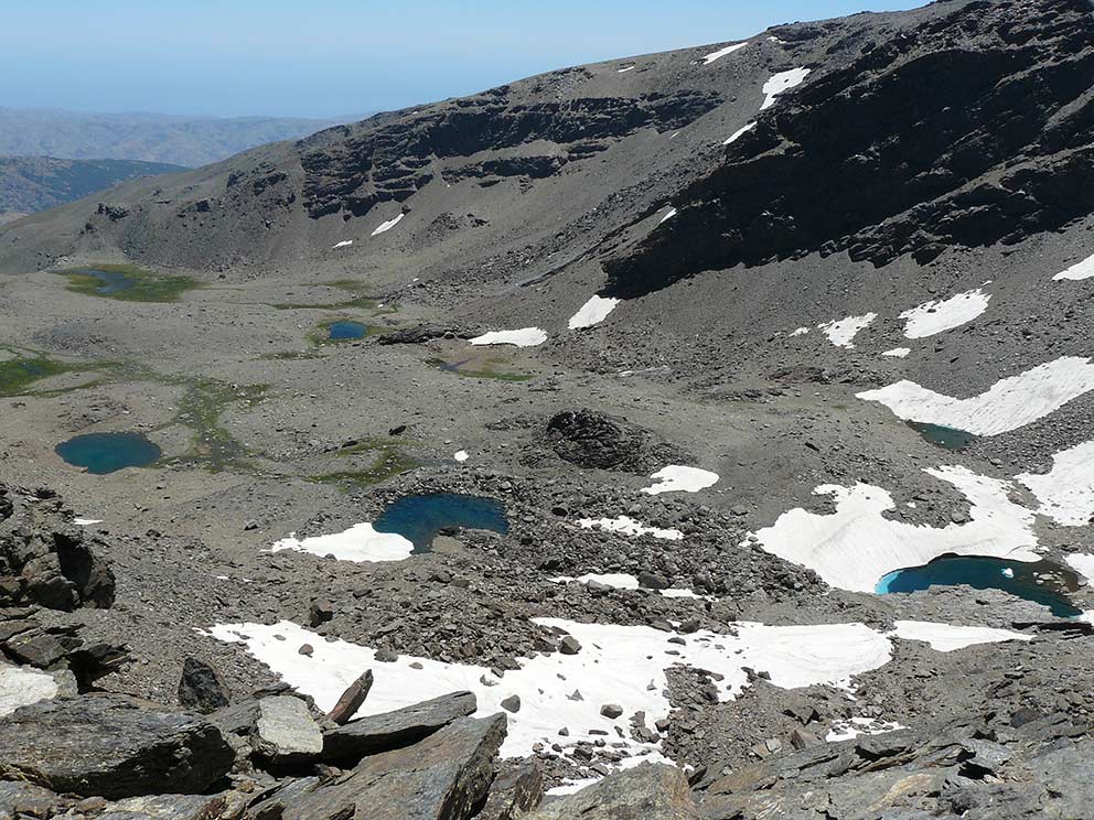
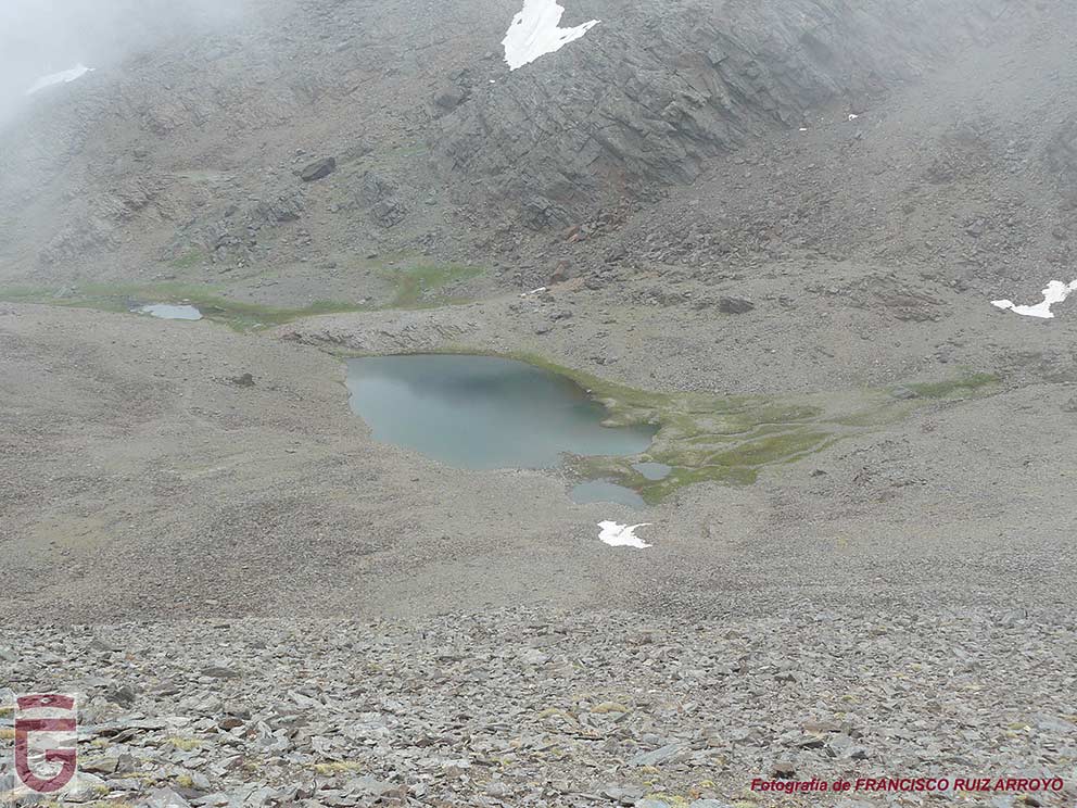
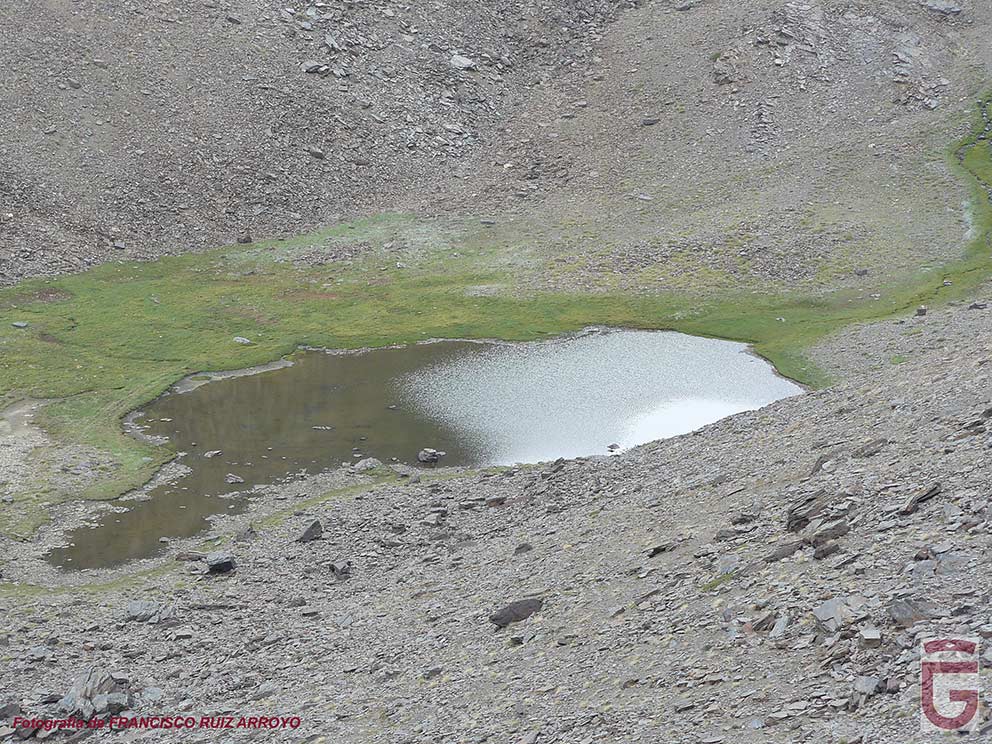
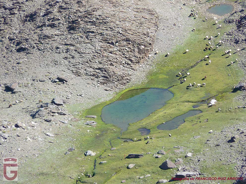
The Collado de Veta Grande is located on the Loma del Lanchar and owes its name to the iron and copper mining that once existed there. From this pass we gain views of the Valdeinfierno River Valley, whose headwaters we will enter following the path that runs halfway down the slope under the steep east face of the Cerro de Los Machos. We will pass by the Lagunillo Bajo de Valdeinfierno (point 5), and, later, by the Lagunillo de La Gabata y Laguna Larga (point 6).

Cabecera del Valle del Río Valdeinfierno
Head of the Valley of the River Valdeinfierno
Lagunillo Bajo de Valdeinfierno y cara este del Cerro de Los Machos
Lagunillo Bajo de Valdeinfierno and eastern face of Cerro de Los Machos
Lagunillo de La Gabata y Laguna Larga bajo el Puntal de la Caldera
Lagunillo de La Gabata y Laguna Larga under the Puntal de la Caldera
Lagunillo de La Gabata
Laguna Larga
Laguna Larga
Gamarza
Gamarza

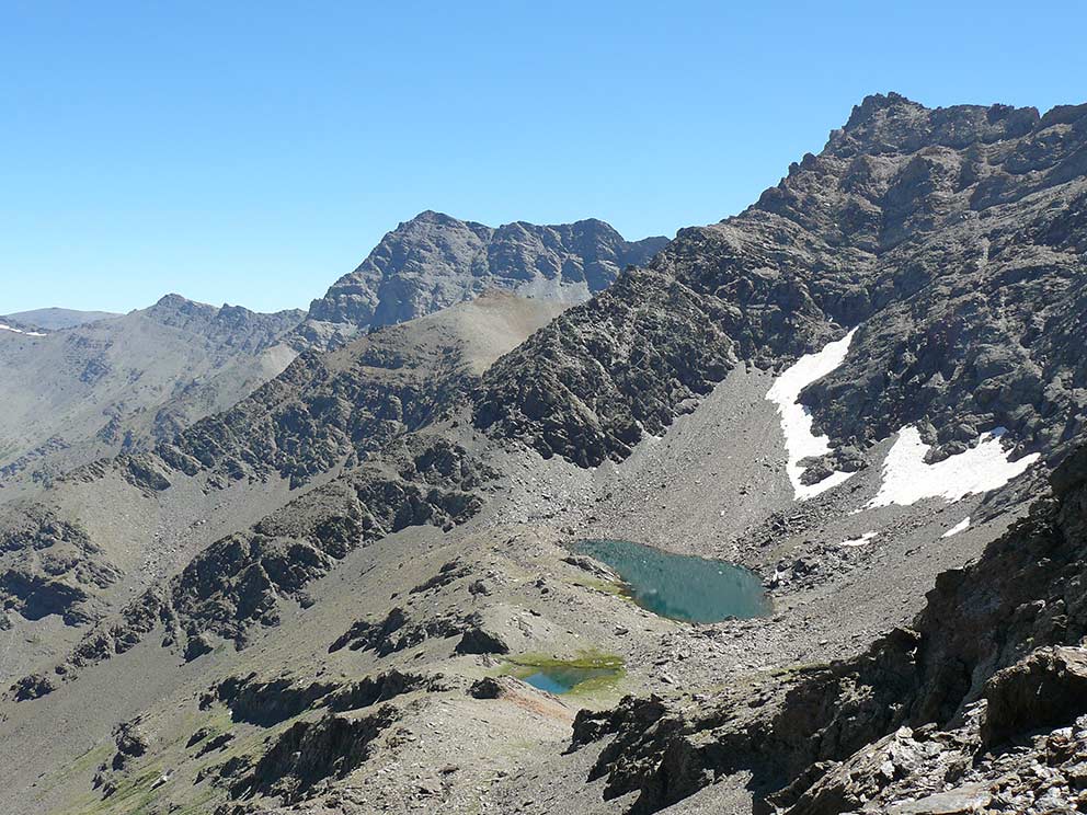
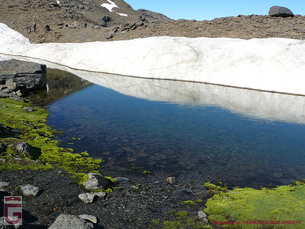
After passing the Espolón del Puntal de La Caldera, we will cross the north face of it. the same. At this point we could find a large snowdrift, which will force us to descend a little if we want to cross it without stepping on snow.

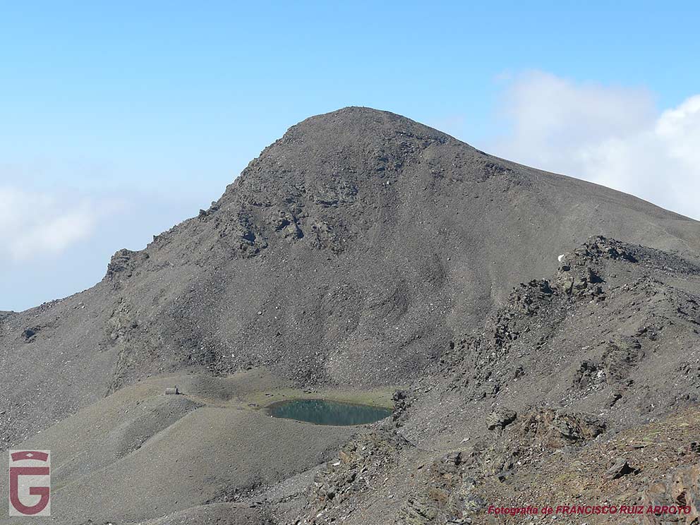
Once we have surpassed the north face of Puntal de la Caldera, we will have to go up the slope that leads us to a small pass located next to the Juego de Bolos peak. From this pass we will enjoy an impressive view of the north face of Mulhacén, which will be high, close, full of spurs, vasares, gendarmes and corridors result of erosion. An example of the erosion to which the Mulhacén is subjected are the canchales of rocks that, like ejection cones, are located at the base of its north face.

Cara norte del Mulhacén
North face of the Mulhacén

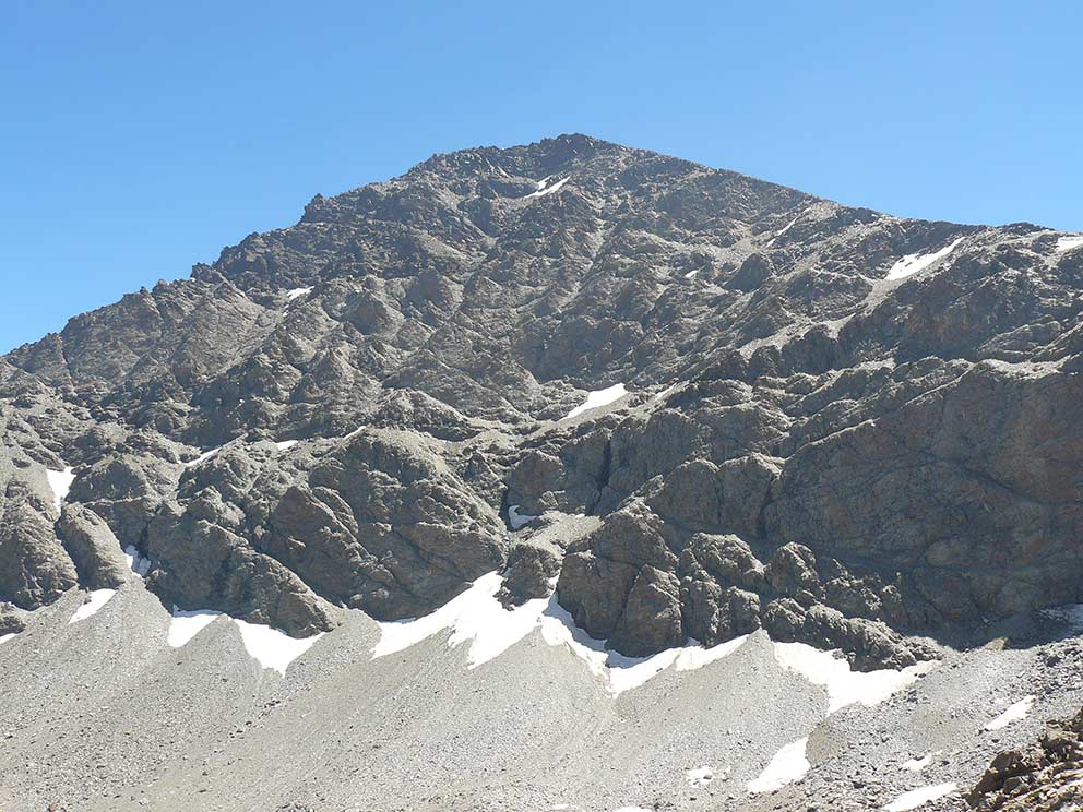
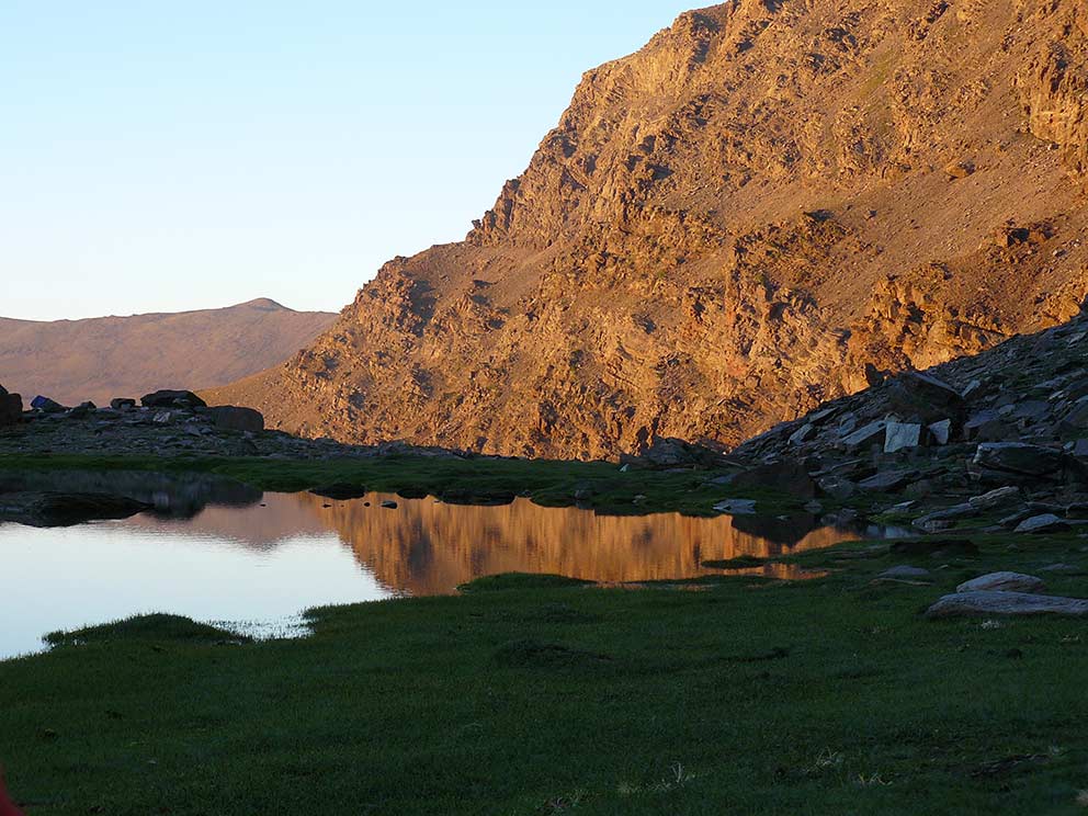
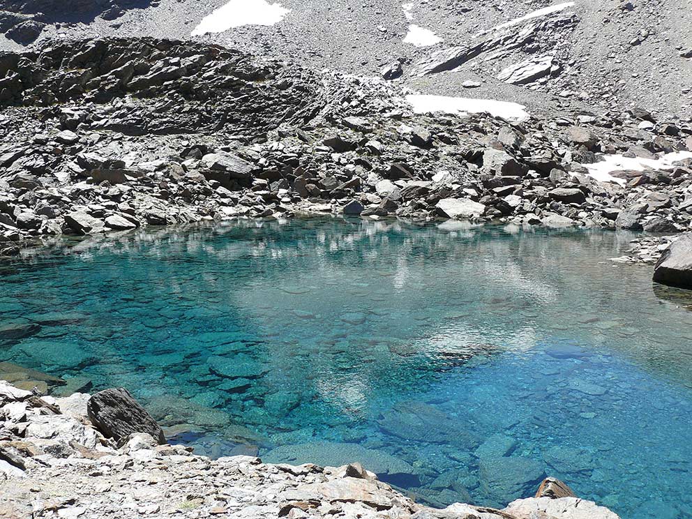
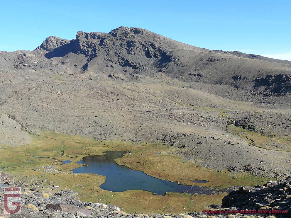
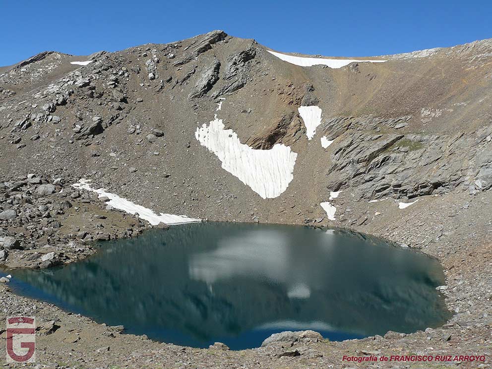
We are in the domains of the Mulhacén, roof of the Iberian Peninsula, and it will be in the vicinity of the Laguna de la Mosca (point 7), located under the north face of this giant, where we will find accommodation to spend our first night.

Something to keep in mind during the crossing, in addition to the prohibition of camping on the sheepfold, is that bathing, personal hygiene and the washing of belongings in the lagoons of Sierra Nevada are also expressly prohibited.

Laguna de la Mosca (o del Mulhacén)
Laguna de la Mosca (or Mulhacén)
Tiraña de Sierra Nevada (insectívora)
Tiraña of the Sierra Nevada (insectivorous)
Desagüe de la laguna de la Mosca
Drainage of the laguna de la Mosca
Macho de cabra montés
Male mountain goat
Laguna de la Mosca y cara oeste de la Alcazaba al atardecer
Anochece en la laguna de la Mosca
Sunset in the laguna de la Mosca

DAY 2: LAGUNA DE LA MOSCA – LAGUNA HONDERA

The second day, we will depart from the Laguna de la Mosca (point 7) towards the Gran Vasar de la Alcazaba. To do this, we must climb the rocky step that flanks the southeast end of the lagoon, and, once on it, follow the milestones that will lead us to the beginning of the vasar (point 8The Gran Vasar is a cornice that crosses the west and north faces of the Alcazaba.

Halfway through our journey through the vasar, we will cross the Espolón de la Alcazaba (point 9), which serves as a hinge between both sides.

Once introduced into the north face of the Alcazaba it is very possible that there are snowdrifts on the vassar. It is likely that these snowdrifts can be overcome through the rimayas that are generated between the wall and the snowdrift itself (as a result of the thaw), but it could happen that we would be forced to step on snow, which would make it necessary to use crampons and ice axe. For all these reasons, it is necessary to be previously informed about the conditions of the varsar (using the sources of knowledge and the recommended forums) in order to equip ourselves with the necessary material or not to walk it.

Gran Vasar de la Alcazaba en su discurrir a través de la cara oeste de la Alcazaba
Gran Vasar de la Alcazaba in its course through
the west face of the Alcazaba
Vista atrás, hacía el Mulhacén, desde el Gran Vasar de la Alcazaba
View back towards the Mulhacén, from the Gran Vasar de la Alcazaba.
Rimaya en el Gran Vasar de la Alcazaba
Rimaya in the Gran Vasar de la Alcazaba

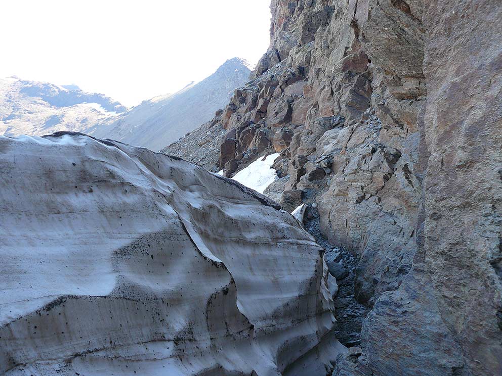
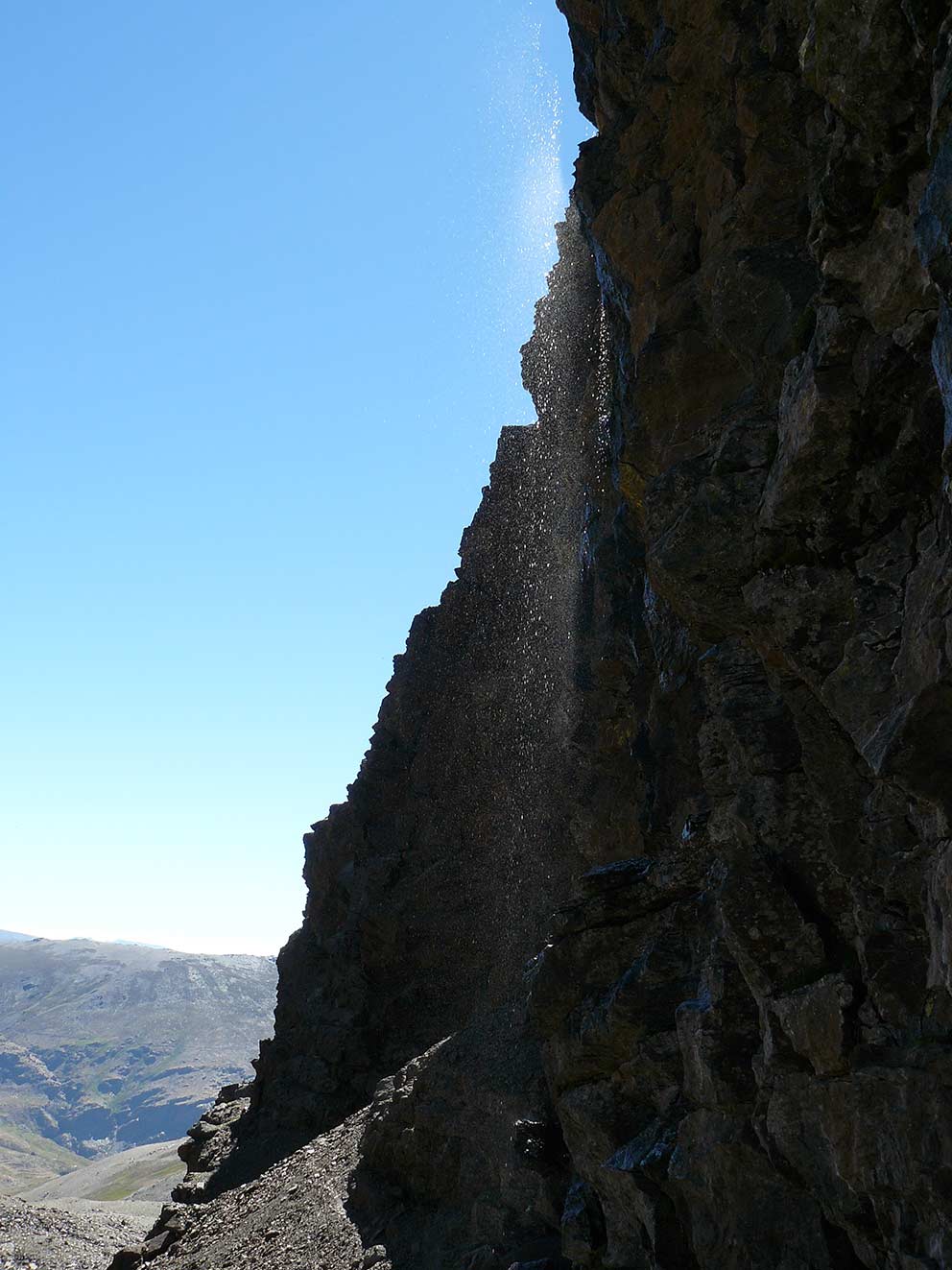
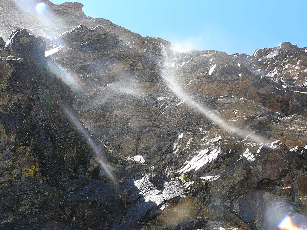
On leaving the Gran Vasar we will find ourselves in the Collado del Goterón (point 10), which is located on the main ridge of the mountain range. From here we will follow the rope until we get under the Puntal del Goterón (point 11), where we will begin to walk the Tajos del Goterón, staying close to the base of the same. This is one of the least frequented places in Sierra Nevada, being far enough away so that reaching it becomes a very demanding undertaking or takes several days. In this magnificent place, the thawing water falls forming curtains of water under which we will pass.

Tajos del Goterón vistos desde el Collado del Goterón (punto 10)
The gTajos del Goterón seen from the Collado del Goterón (point 10)
Puntal del Goterón (punto 11)
Puntal del Goterón (point 11)
Cortina de agua que da nombre a los Tajos del Goterón (punto 12)
Curtain of water, which gives its name to the Tajos del Goterón (point 12)
Cortina de agua bajo los Tajos del Goterón (punto 12)
Curtain of water under the Tajos del Goterón (point 12)

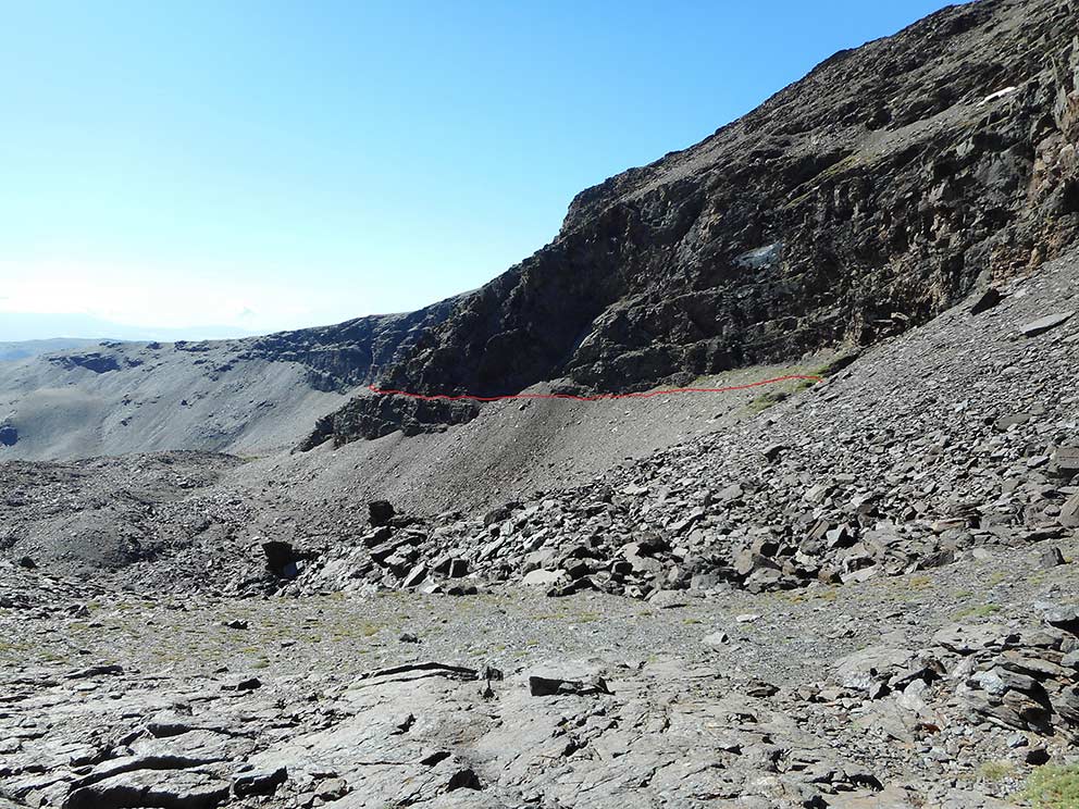
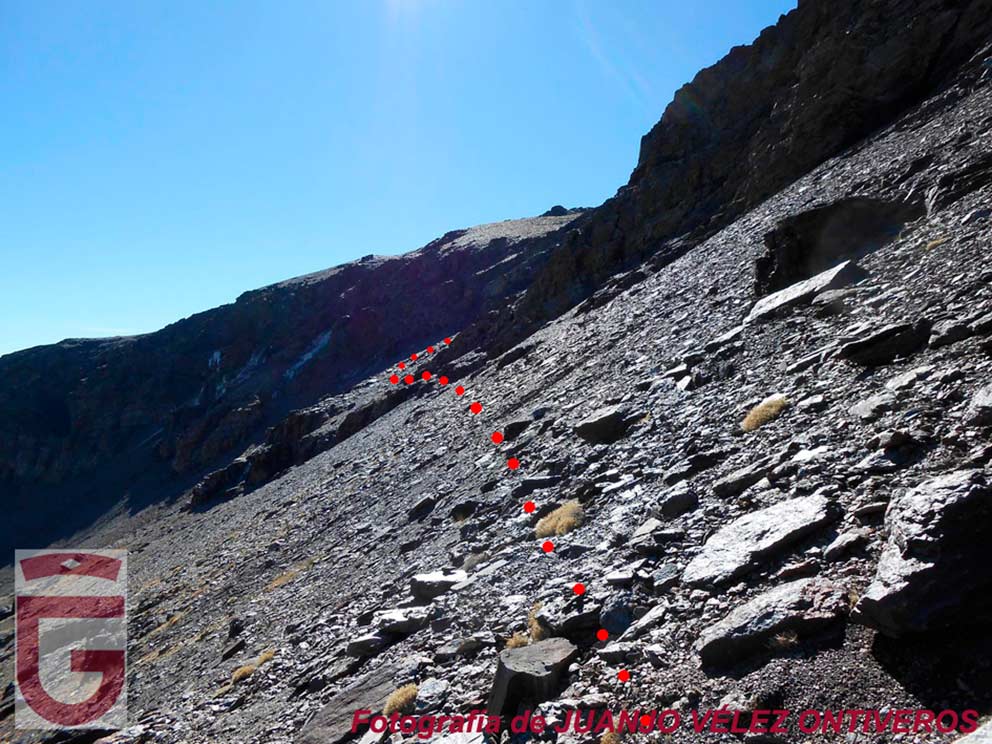
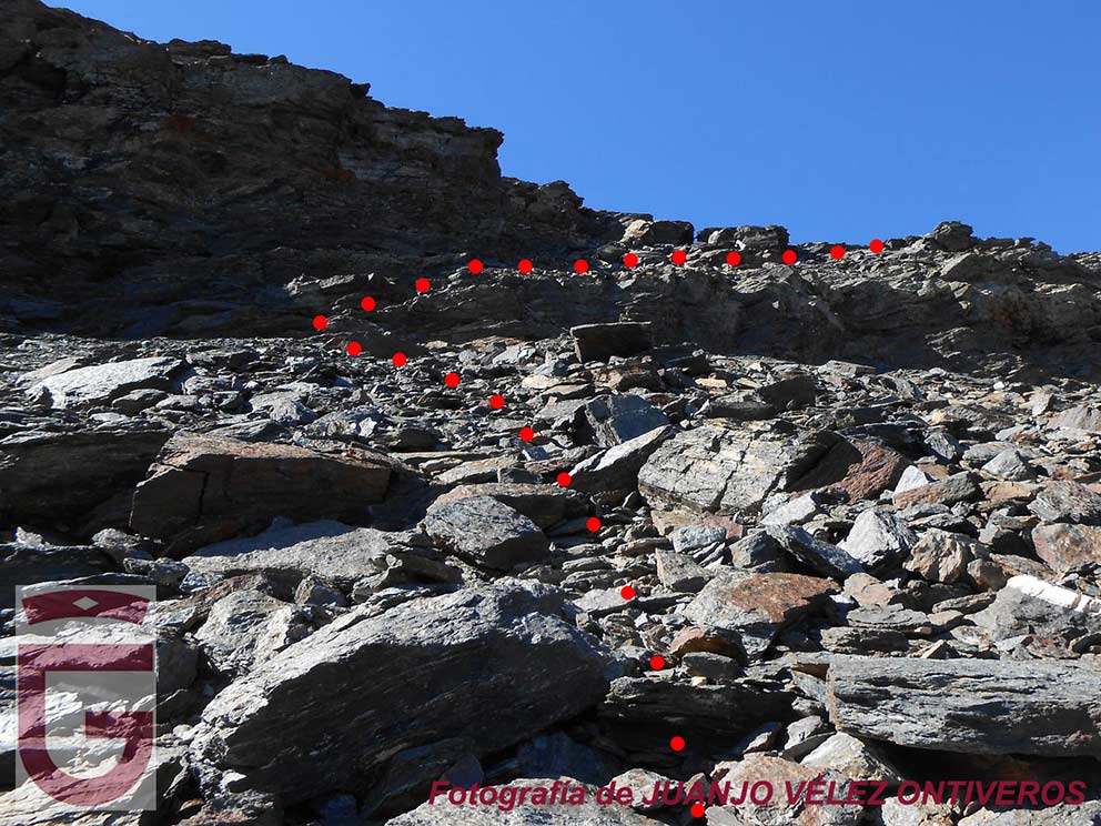
To get out of the Tajos del Goterón we will use the narrow ledge at the end of them (point 13). After crossing this ledge, the wall along which we are running loses slope, becoming a hillside. We will continue along this slope for about 450 meters, in a slight and diagonal ascent, looking for the Paso de la Z. The pass begins by overcoming the rocky step that is located in front of us (point 14Once we have overcome this step, we will reach an area of large blocks and begin to climb facing the slope, very steep here, looking for the most obvious way to overcome the wall that tops the slope. Once we have overcome this last difficulty, we will have reached the Cañada de los Borregos (point 15).

Cañada del Goterón
Cañada del Goterón
En busca del Paso de la Z (punto 14)
In search of the Paso de la Z (point 14)
Tramo final del Paso de la Z (punto 15)
The final section of the Paso de la Z (point 15)

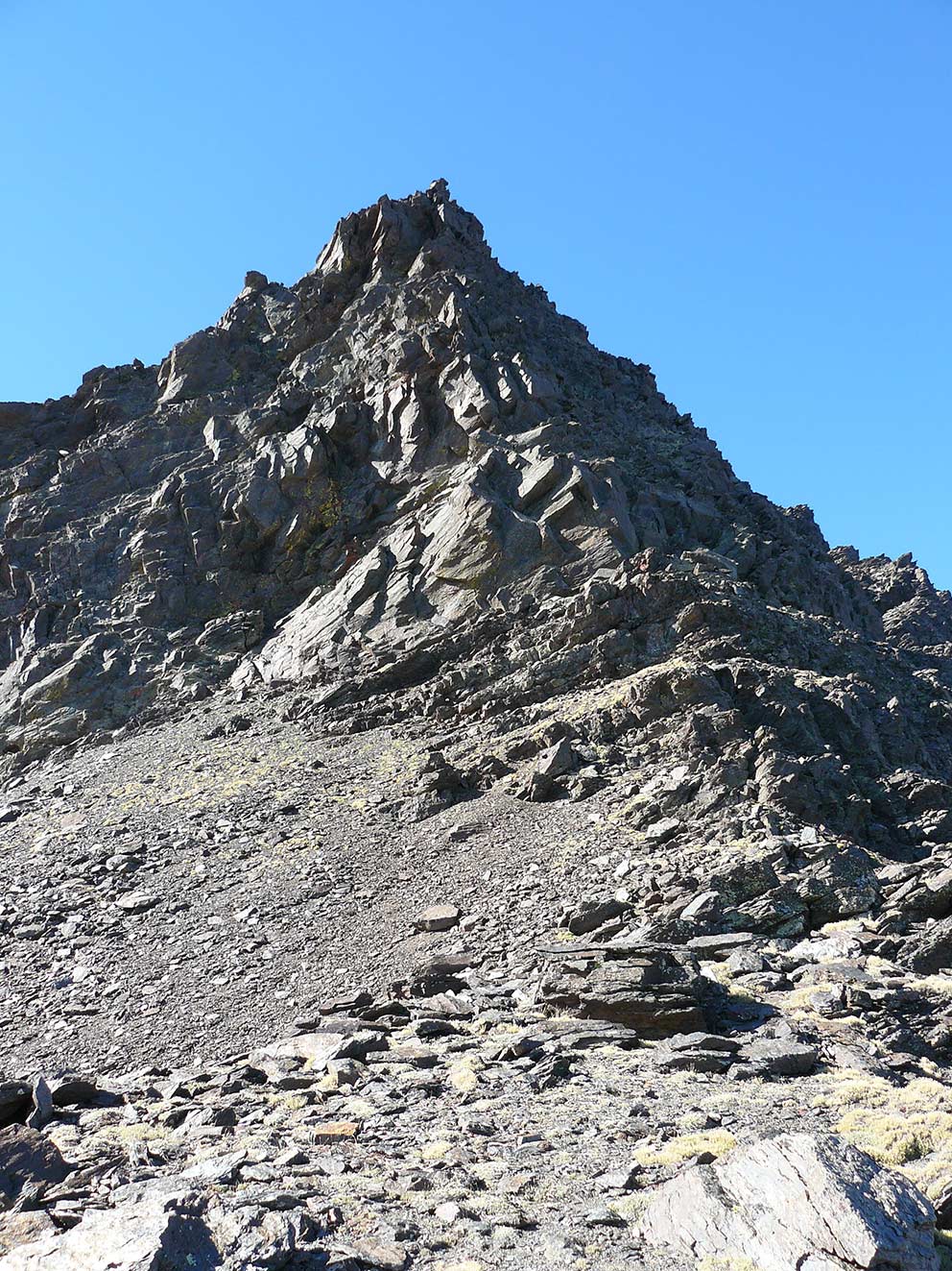
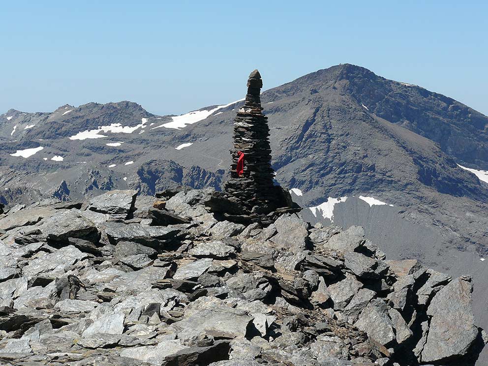
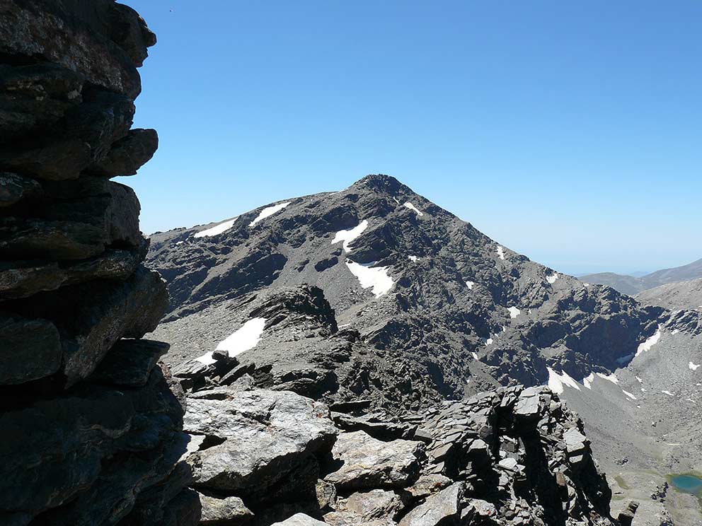
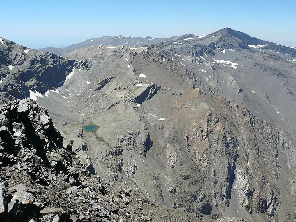
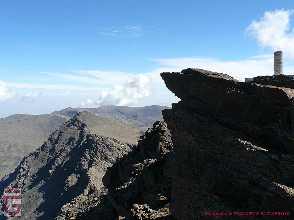
Once we are on the Cañada de los Borregos we will have to gain altitude through the right flank of this great hanging valley until we reach the top of the Alcazaba, at 3,369 meters above sea level (point 16). This emblematic summit offers views in all directions, being able to contemplate from it almost all the peaks with a minimum of 3000 meters of height of Sierra Nevada.

Lagunas de las Calderetas y Puntal de Vacares vistos desde la subida a la Alcazaba
Lagunas de las Calderetas and Puntal de Vacares
seen from the ascent to the Alcazaba
Middle and lower lagoons of the Calderetas
Cima de la Alcazaba
Top of the Alcazaba
El Mulhacén visto desde la cima de la Alcazaba
The Mulhacén seen from the summit of the Alcazaba
Vistas hacia el oeste desde la cima de la Alcazaba
View to the west from the summit of the Alcazaba
La Laguna de la Mosca, y su chorrera, vistas desde la cima de la Alcazaba
The Laguna de la Mosca, and its watershed, seen from the top of the Alcazaba.

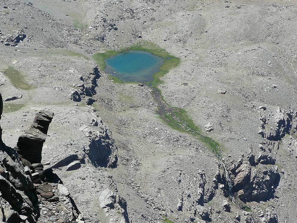
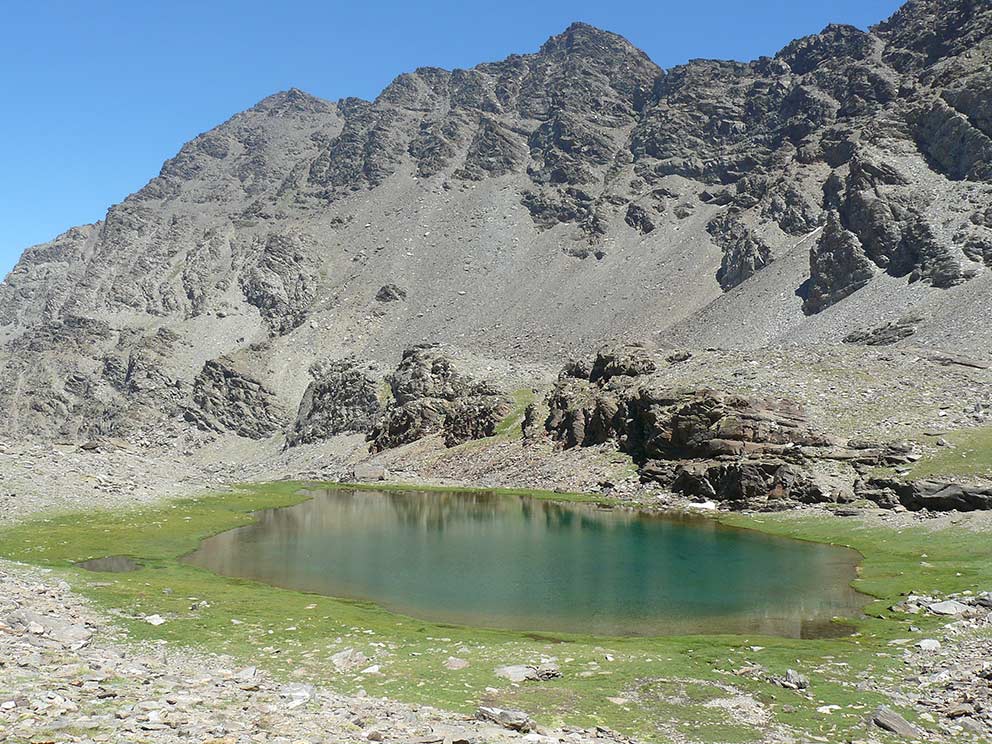
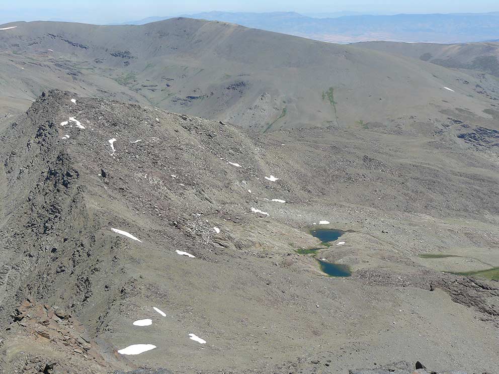
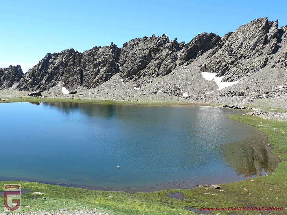
After enjoying the great views that this summit offers us, we will descend to the south, looking for the pass located between the Puntal de la Cornisa and the Tajos Coloraos. This pass gives access to the Colaero (point 17), step that allows us to descend somewhat abruptly to the Cañada de Siete Lagunas. We will cross this wonderful place passing by most of the lagoons that compose it (there are 9, not 7, in the thawing season), until we reach the lowest of them all and that is therefore called Hondera (point 18). Next to the Laguna Hondera we will spend our second night.

Cañada de Siete Lagunas
Laguna Altera
Laguna Altera
Laguna Hondera
Laguna Hondera
Saxifraga estrellada

DAY 3: LAGUNA HONDERA – LAGUNA DE AGUAS VERDES

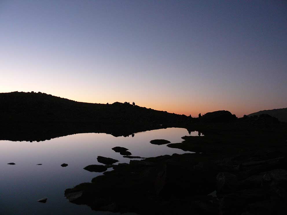
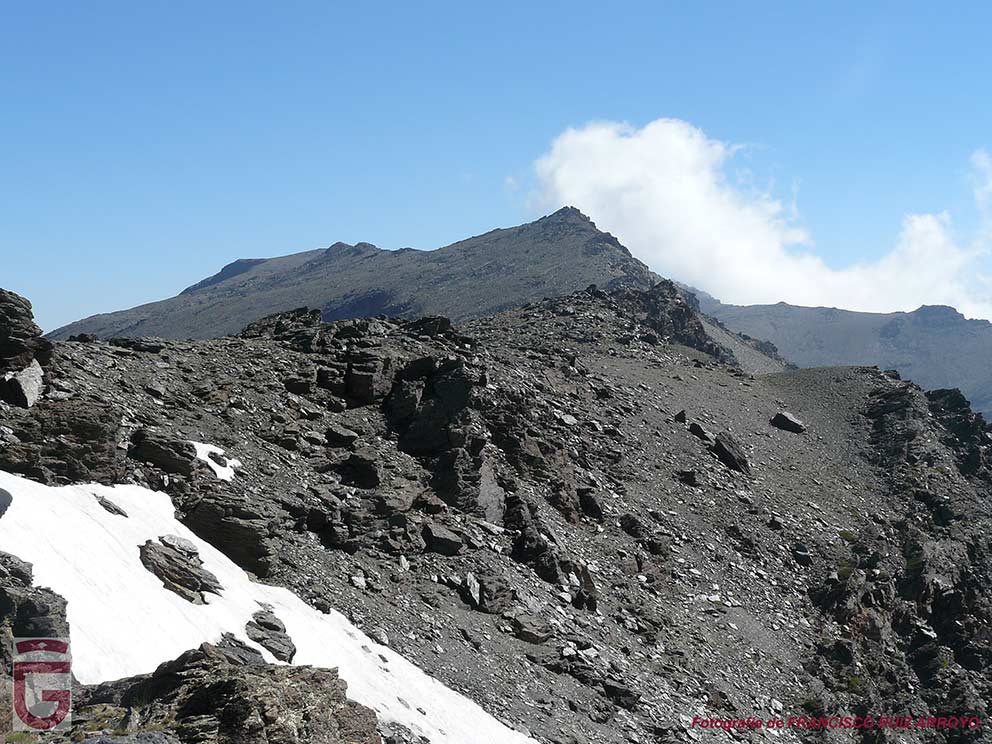
If we are early risers, seeing the sunrise from the Laguna Hondera (point 18), located at an altitude of 2,900 m., is a spectacle for the senses. Once we have gathered our gear, we will begin the day by taking the path that starts from the lagoon to the south, and that, after a zigzagging ascent, takes us to the Cuerda del Resuello. Once located on this hill, we will begin to climb it. After a few meters our path forks, leading to the left to the Alto del Chorrillo. We ignore this detour and continue up the hill until we reach the summit of Mulhacén after approximately 1 hour and 45 minutes of ascent.

Laguna Hondera vista desde la Cuerda del Resuello
Laguna Hondera viewed from the Cuerda del Resuello

The summit of Mulhacén (point 19), with 3.478 m., is always very busy in summer. This will be the day of our trip when we will meet the most people.

From the geodesic vertex of Mulhacén we can look out to the north face of this giant, being able to see the Laguna de la Mosca far below and, at the same time, very close, which is a dizzying view. The valley of the Genil River opens at our feet.

Cima del Mulhacén
Summit of Mulhacén
Laguna de la Mosca y Valle del Genil, vistos desde la cima del Mulhacén
Laguna de la Mosca and Valle del Genil, seen from the summit of Mulhacén

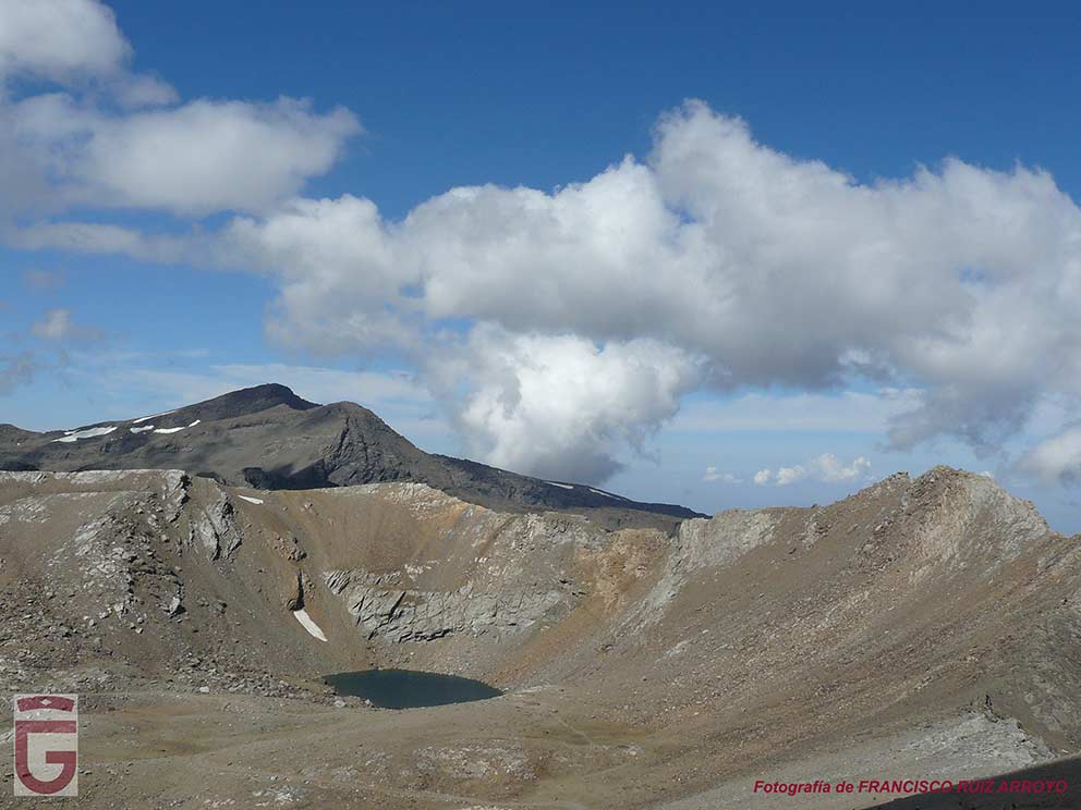
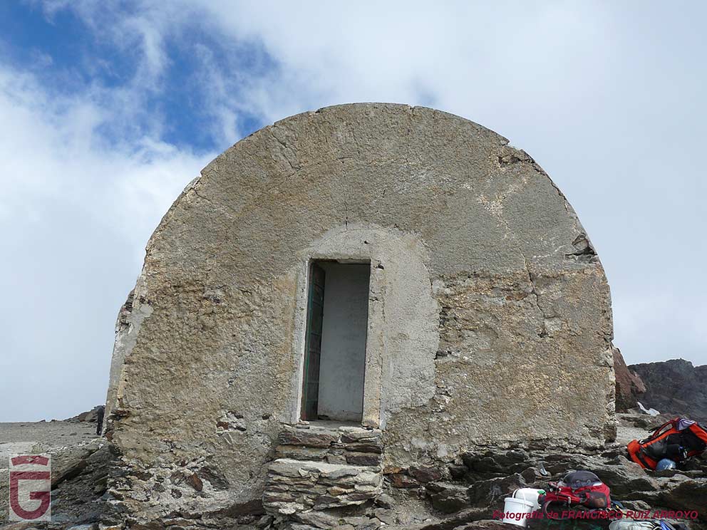
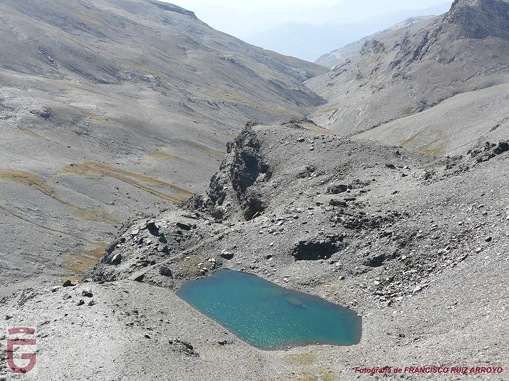
Once we have climbed the top of the peninsula, we retrace our steps to, soon, begin to descend through its west face. Halfway down we will follow the path that brings us closer to the Collado del Mulhacén or del Ciervo, which we can approach to enjoy a last panoramic view of the north face of Mulhacén and the Laguna de la Mosca. Once we have enjoyed this view, we will continue descending towards the Refugio-vivac of La Caldera (point 20), located next to the lagoon from which it receives the name (point 21).

Bajando la cara oeste del Mulhacén
Down the west side of the Mulhacén
Laguna de la Mosca vista desde el Collado del Ciervo
Laguna de la Mosca viewed from the Collado del Ciervo

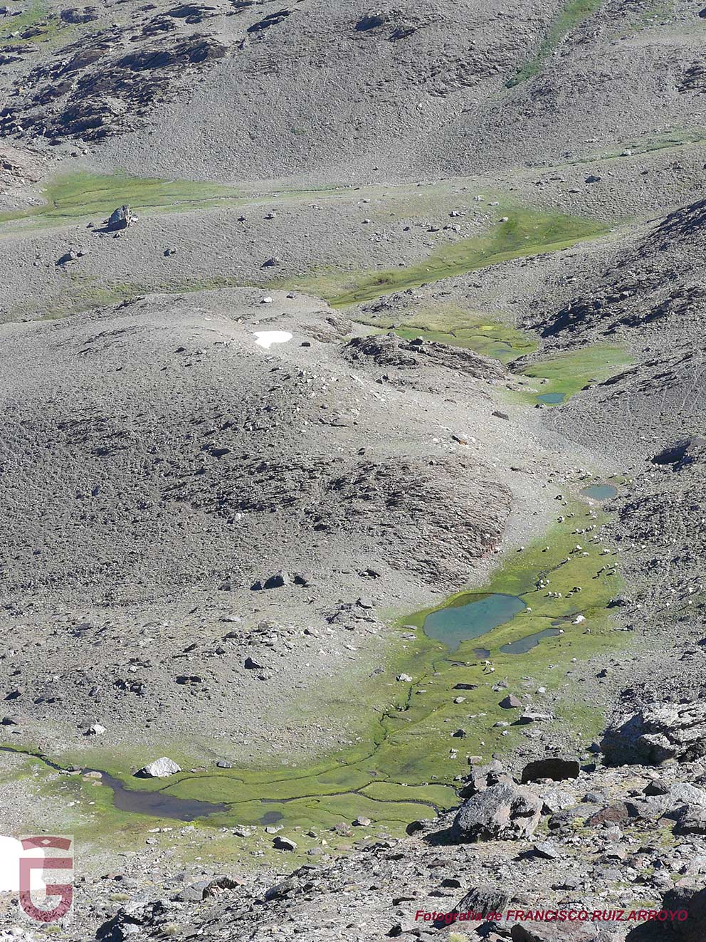
We will then follow the path that starts at the refuge and that, halfway up the slope, goes along the deep basin of the Laguna de La Caldera until we get to Loma Pelá (point 22Leaving the basin we could find a snowdrift as a cornice that forces us to take extreme precautions (in case of lacking enough material and experience, we recommend not to follow this path and choose to take the path that, starting from the Refugio-vivac La Caldera, allows us to go around Loma Pelá passing through the Refugio-vivac Villa Vientos).

Laguna de La Caldera (a la derecha, sendero que remonta la cubeta)
Laguna de La Caldera (to the right, path that goes up the basin)

Once past Loma Pelá we will find ourselves in the domains of Río Seco, through whose headwaters (again, a glacial cirque), runs the remnant of what was the road that linked Granada capital with the Alpujarra. We will join this route, constituting a comfortable and wide path today. Below, to our left, we will see the Laguna de Río Seco (point 23), a lagoon next to which was located the Refugio Félix Méndez, a guarded refuge that came to be replaced in 1997 by the Refugio Poqueira (located further down, next to the Mulhacén River). Above the lagoon we will see the Raspones de Río Seco, with its jagged profile.

Laguna y Raspones de Río Seco
Lagoon and Raspones de Rio Seco
Philonotis seriata
Philonotis seriata
Dragoncillos de Sierra Nevada
Dragoncillos of the Sierra Nevada

After crossing the Puerta (excavation in the rock that facilitated the passage of the old road), we will arrive at the Collado del Lobo, from which we will look out over the east face of the Cerro de Los Machos and the valley of the Valdeinfierno River. We will continue along the path and, after overcoming the well-known Paso de Los Machos (be careful with this pass, because it is exposed when it has snow), we will have the possibility of taking the path (point 24) that ascends to the Cerro de Los Machos, enjoy the views of the north face and the Corral del Veleta from its summit (point 25) and return through the same place until we rejoin our original path (point 24).

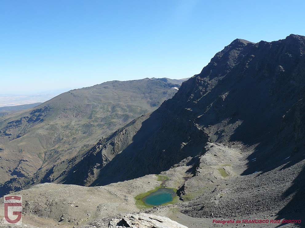
From here we will have little left to complete the day's journey. We already notice the presence of the Veleta, whose abrupt south face is the one that now offers us. Following our way we will arrive at the Lagunillo del Veleta (point 26). At this point we must leave the route of the old road and go down to the Aguas Verdes Lagoon (Laguna de Aguas Verdes) (point 27), a lagoon that is located in the Vasares del Veleta and on the glacial valley through which the river of the same name flows. Next to this beautiful lagoon we will spend our third night.

Laguna de Aguas Verdes sobre los Vasares del Veleta, bajo el Puntal de Loma Púa
Aguas Verdes Lagoon on the Vasares del Veleta,
under the Puntal de Loma Púa
Genciana
Gentian

DAY 4: LAGUNA DE AGUAS VERDES-LAGUNA DEL CABALLO

The fourth day of our journey, we start from the Laguna de Aguas Verdes (point 27), undoing part of the path followed the previous day, to rejoin the old route of the road that connected Granada capital with the Alpujarra.

Laguna de Aguas Verdes y Valle del Río Veleta, vistos desde el trazado de la antigua carretera Granada-Alpujarra
Laguna de Aguas Verdes and Valley of the River Veleta,
seen from the route of the old Granada-Alpujarra road.

Once we are on this route, we will follow it (leaving it on a couple of occasions to continue the ascent by path) until we reach the Refugio-vivac de la Carihuela (point 28), a refuge that sits next to the hill from which receives its name.

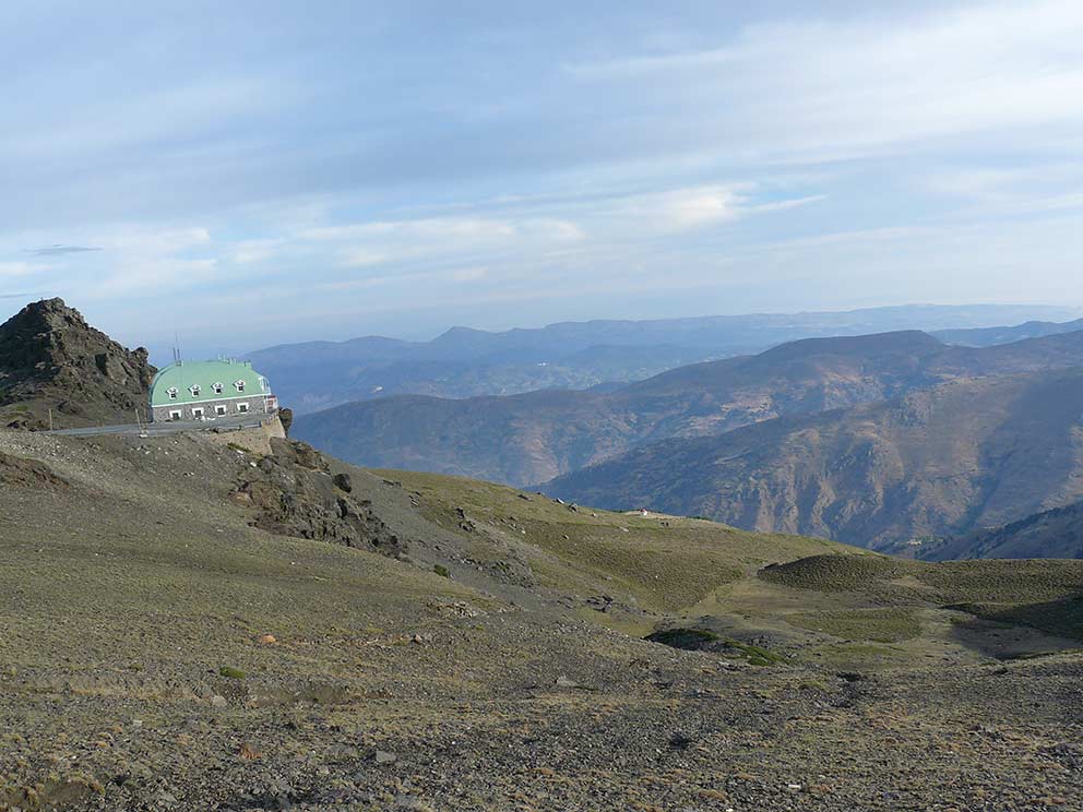
From this refuge, being able to hide the luggage in its surroundings, and pick it up on the way back, we opted to climb lightly to the top of the Veleta, with 3,398 meters above sea level (point 29).

Views from the summit of the Veleta (point 29)

After climbing the third highest peak of the Iberian Peninsula (behind Mulhacén and Aneto), we will retrace our steps, pick up our backpacks (previously hidden in the surroundings of the Refugio-vivac La Carihuela ( point 28) and, after going around the Puntal de Loma Púa on the right, we will arrive at a pass from which we will begin the cresting that involves crossing the Tajos de la Virgen following faithfully the main rope of the mountain range. If we would like to avoid the complicated section that exists in this crossing (exposed pass and grade II climbing), we will take the path that leaves to the left from the aforementioned pass. This path, somewhat diffuse, although marked with milestones, runs along the southern slope of the Tajos de la Virgen halfway up the slope, and, although it requires the use of the hands in its final stretch, it will allow us to return to the rope once we have overcome the cuts without having faced great difficulties.

Once past the Tajos de la Virgen (point 30), we will continue progressing along the rope, now without any difficulty, until we reach the base of the Fraile de Capileira. After passing by this slender rock gendarme, we will face a new crest as we cross the Tajos del Nevero (point 31). The passage through these pits is marked with milestones and is not difficult, except for the difficulty of finding the right path through a complete chaos of rocks.

Tajos del Nevero (punto 31), vistos desde la salida de los Tajos de la Virgen (punto 30)
Tajos del Nevero (point 31), as seen from the exit
from the Tajos de la Virgen (point 30)
Fraile de Capileira
Fraile de Capileira
Tajos de la Virgen (punto 30) vistos desde los Tajos del Nevero (punto 31)
Tajos de la Virgen (point 30) seen from the Tajos del Nevero (point 31)
Tajos del Nevero
Tajos del Nevero
Chicharra de montaña  (Baetica ustulata, especie endémica amenazada de Sierra Nevada)
Mountain cicada
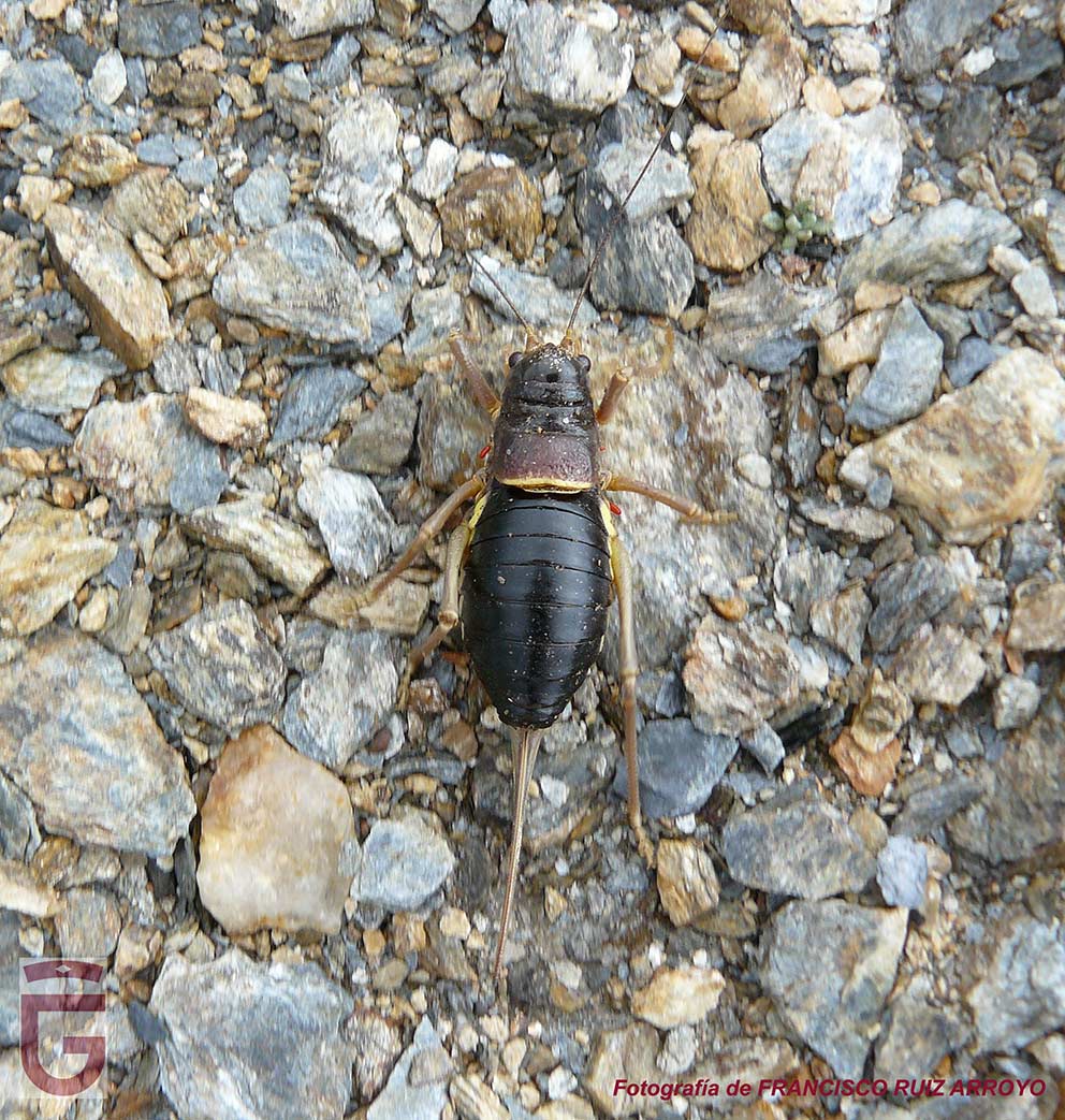
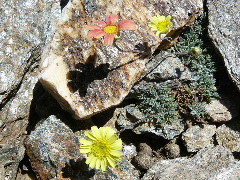
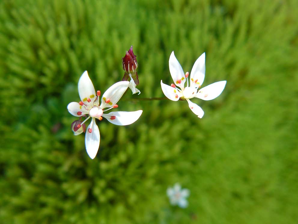
(Baetica ustulata, threatened endemic species of Sierra Nevada).

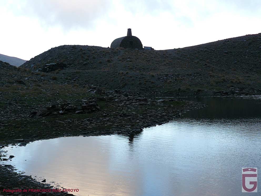
After leaving the Tajos del Nevero, we will continue walking on the rope. Soon we will pass next to a rain gauge, and, soon, next to a cistern. The cistern indicates that we are just above the Refugio Elorrieta (point 32). This old forest shelter has a part excavated in the rock that makes it unique and worth visiting. The poor state of the roof of the constructed part makes it uninhabitable when it rains, since it presents numerous leaks and the interior of the same one gets completely flooded.

Refugio Elorrieta (punto 32)
Shelter Elorrieta (point 32)

We are at the upper end of the Lanjarón Valley, which now opens up beneath our feet. The mule trails that run through this valley all culminate in the Refugio Elorrieta, and, like this one, and the other shelters that mark the upper part of the valley, were built in the early 30s of the last century as part of the reforestation plans undertaken here at that time.

The path that we will follow once we have left behind the Elorrieta Refuge, once we have entered the Lanjarón Valley, is called Verea Cortá. This path has a route that is undoubtedly one of the most spectacular in the mountain range, as it runs through the vasares, and crosses the gorges, of the northern slope of the Lanjarón Valley, allowing us to enjoy all the lagoons, ponds and pools that exist there.

Valle de Lanjarón
Valley of Lanjarón

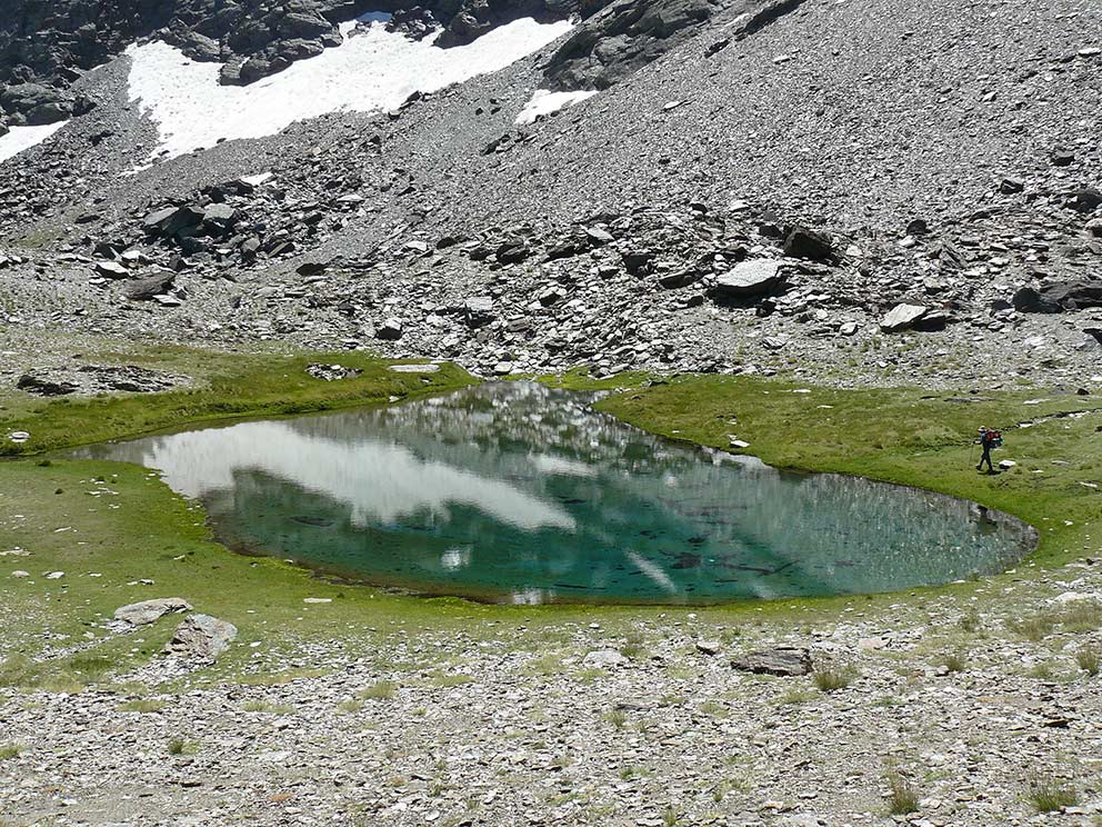
As soon as we start descending from Refugio Elorrieta we will see below, to our right, the Lagunillo and Laguna de Lanjarón (point 33). After fording the River Lanjarón, already on Verea Cortá, we will find the Lagunillo de Charca Pala (point 34). Continuing along the path we will pass by four ephemeral ponds known as Charcas de Tajos Altos (item 35), and, later, on a small landing, you will find the lake of Tears High (item 36), located just under the summit from which it gets the name.

Lagunillo y Laguna de Lanjarón (punto 33)
Lagunillo and Laguna de Lanjarón (item 33)

Laguna de Tajos Altos (punto 36)

Laguna de Tajos Altos (point 36)

Past the Laguna de Tajos Altos, the slope of our mid-slope increases until it becomes a gorge. It is here that we find the pass to which Verea Cortá owes its name. It is a narrow channel where the trail disappears and must be crossed with the help of a chain arranged as a handrail. It is not at all a difficult pass.
After this point, Verea Cortá becomes a trail again and, soon after, it takes us to Laguna Cuadrada (point 37). It seems that the sidewalk would have served to regulate the high-water of this lake, (to dam), with a spillway.
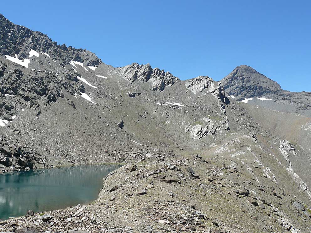
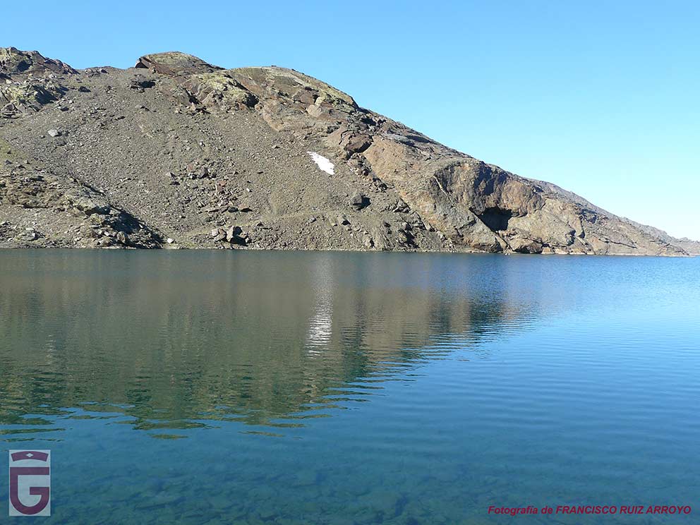
After facing a winding descent and traverse longitudinally several vasares, we will begin to sense imminent end of our day. We will see very close to the Lagoon of Nájera (point 38), which is situated beneath the path, and, soon, we will come to the Laguna del Caballo (point 39), located in a glacial basin on whose moraine is located the Refugio-Vivac del Caballo (point 40).

Laguna de Nájera (punto 38)
Laguna de Nájera (item 38)

Laguna y Refugio del Caballo (puntos 39 y 40)Lagoon and Shelter of the Caballo (points 39 and 40)

DAY 5: LAGUNA DEL CABALLO – HOYA DE LA MORA

The fifth and final day of our journey, we will depart from the Laguna del Caballo (point 39), and, after walking halfway up the eastern and southern slopes of the Cerro del Caballo, we will reach the site of the remains of the unfinished Lanjarón Refuge (point 41). From then on, we will leave the path that has led us there (and that would take us down the valley), and turn right to start going up the hill looking for a comfortable way to climb up to the geodesic vertex that crowns the top of Cerro del Caballo (Cerro del Caballo) (item 42).

Cabras monteses en las inmediaciones de la Laguna y del Refugio-vivac del Caballo (puntos 39 y 40)
Mountain goats in the vicinity of the Laguna and the Refugio-vivac del Caballo (points 39 and 40).
Cara Sur del Cerro del Caballo, vista durante la subida al mismo desde el sanatorio inacabado (punto 41). Aljibe destinado a servir al sanatorio y situado en la Hoya del Zorro.
South face of Cerro del Caballo, seen during the ascent to it from the unfinished sanatorium (point 41). Cistern destined to serve the sanatorium and located in the Hoya del Zorro.

From the Cerro del Caballo, with 3,011 meters above sea level, the westernmost three thousand of the massif, we can contemplate the best view of the Alto Valle de Lanjarón. Immediately below us we will see the Laguna and the Refugio del Caballo, being able to distinguish perfectly the channel excavated in the moraine of the glacial basin and whose purpose was to drain the lagoon for agricultural purposes in a time of intense drought (in the late 70s of the nineteenth century). Fortunately, this enterprise was soon paralyzed. Today, scientists are studying the possibility of restoring the moraine and recovering the water level of the original lagoon, although this is an extremely costly task.

Vista hacia el Alto Valle de Lanjarón desde el Cerro del Caballo (punto 42)
View of the Upper Lanjarón Valley from Cerro del Caballo (point 42)
Cuerda Alta y Alto Valle de Lanjarón, vistos desde el Cerro del Caballo (punto 42). Laguna y del Refugio-vivac del Caballo (puntos 39 y 40)a nuestros pies
Cuerda Alta and Alto Valle de Lanjarón, seen from Cerro del Caballo (point 42). Lagoon and the Refugio-vivac del Caballo (points 39 and 40) at our feet.

We will descend from the summit of the Cerro del Caballo towards the pass that leads to the Laguna and the Refugio-vivac del Caballo if the approach is made from the northern slope of the mountain range. Once located in this pass, we will begin to cross the footpath that runs on the rope that delimits the Valley of Lanjarón by the north. In our progress through this rope, called Cuerda Alta, we will be able to tread on two three thousanders: Tajos Altos, with 3.111 msnm. (point 43), and the Tozal del Cartujo, with 3.152 m above sea level. (item 44).

Laguna de Nájera (punto 38) bajo el Morrón
Laguna de Nájera (38) under the Morrón
Laguna, Refugio y Cerro del Caballo (puntos 39,40 y 42), vistos desde Cuerda Alta
Laguna, Refugio and Cerro del Caballo (points 39, 40 and 42), seen from Cuerda Alta.
Cuerda Alta
Cuerda Alta
Laguna Cuadrada (punto 37), vista desde Cuerda Alta
Laguna Cuadrada (point 37), viewed from Cuerda Alta

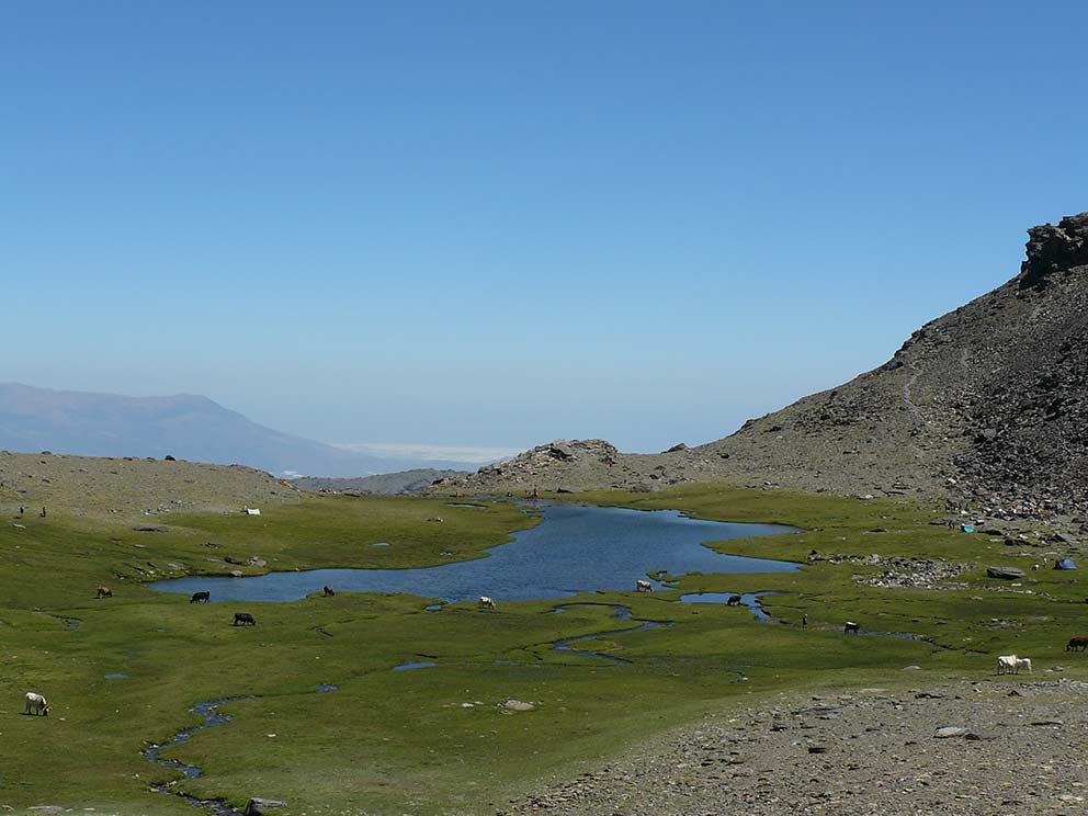
Cuerda Alta ends at the feet of the Shelter Elorrieta (point 32), a place where we will distinguish the rows of stones that make up the quadrangular perimeter of what was once a botanical garden. Once we join the Vereda de Elorrieta, the path that leads to the refuge from the Lagunillos de la Virgen, we will begin to descend along it, now fully introduced in the headwaters of the Dílar River Valley. As we go down we will leave the northern slope of the Tajos del Nevero to our right. Down, to our left, we will see the Lagunillos de la Ermita, and, soon, we will arrive at the Lagunillos de la Virgen (point 45), located under the gorges of the same name. From this moment we will enter the domains of the Sierra Nevada ski resort.

Lagunillos de la Ermita
Lagunillo Medio de la Ermita
Lagunillo Grande de la Virgen
Borreguiles encharcados de los Lagunillos de la Virgen
Waterlogged Borreguiles of Los Lagunillos de la Virgen
Estrellas de las Nieves

We will then pass next to the Embalse de las Yeguas (point 46), an ancient natural lagoon that was unfortunately dammed in 1976. The place of the Laguna de las Yeguas was the place chosen by the first hikers of Sierra Nevada (in the late nineteenth and early twentieth centuries) to establish their high altitude camps and undertake from there their forays into the high mountains. At that time the sierra was accessed by horseback, following the old Camino de Los Neveros from the city of Granada.

Embalse de las Yeguas (punto 46)
Embalse de las Yeguas (point 46)
Embalse de las Yeguas (punto 46)
Embalse de las Yeguas (point 46)

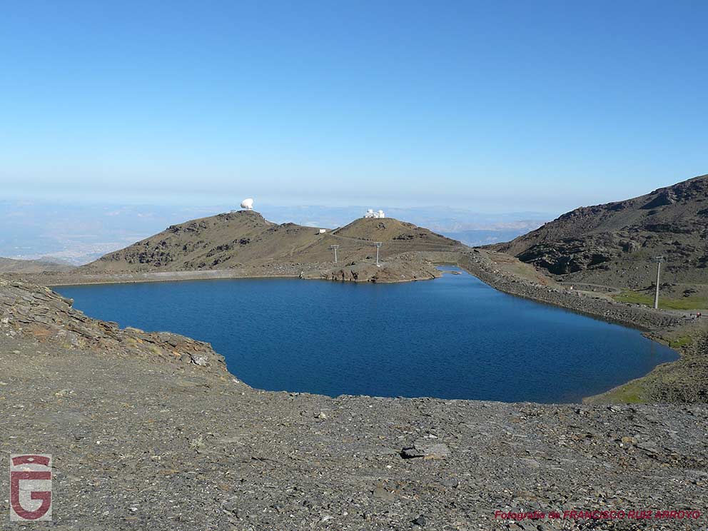
After leaving the Embalse de las Yeguas reservoir, we will advance along the lane that starts there and, once we have passed the Collado de la Laguna, we will cross Borreguiles (point 47After Borreguiles, we will follow the path that leads to the paved lane that connects the ski resort (Borreguiles area) with Hoya de la Mora. This lane in turn leads to the old road that connected Granada capital with the Alpujarra, now restricted to traffic. Although the road winds over the Loma del Veleta, we will leave it several times following the sections of path and lane that allow us to shorten the route and, soon, we will have arrived at the Hoya de la Mora (point 0), start and end point of our long journey to circulate through the high mountains of sierra nevada.

The tracks for GPS in general, and, in particular, registered in ravines, corridors, corners and other tight places, generally contain inaccuracies.

Most of the GPS reflect the graphic scale of the map in the screen. As we activate the zoom of the device, the scale of the map will vary. If we “get closer to the ground,” the scale of the map decreases, and, consequently, we see a smaller amount of “ground” than if we “get away” from it, that is to say, that we increase the scale of the map.

When you follow a downloaded and previously stored track in our GPS, we must ensure that the scale of the map on which the path appears is never too small. We will seek to “get away” from the floor, and we will not obsess with faithfully following the stored track , because we may not notice the inaccuracies that the latter contains.

The precision of the GPS is used to record the route was a, and the GPS that we are using for doing it is another, and therefore, it will be impossible that the points of both tracks, which serves us as a guide and that we are recording, match at 100%. It is for this reason that, even with a single way to move from a particular place, let us note that the track serves us guide runs several meters to the right or to the left of our location.

This website is translated into English. Please note that, in general, there may be a discrepancy between the Spanish and English versions, due to the translation process, and the interpretation that may exist in different countries of the specific terminology of the proposed activities. The Provincial Council of Granada advises the user to be careful when following the instructions on the site, and to consult an expert in case of doubt. The user is aware of the importance of carefully reading these warnings. The use of this website implies the full acceptance of the terms and conditions contained in this legal notice.

Responsibility

The Provincial council of Granada can not assume any liability arising out of the misuse, improper or unlawful use of the information displayed on the Internet page of www.exploregranada.es.

The Provincial council of Granada disclaims any liability resulting from the misuse of the content of its website and reserves the right to update, remove, and restrict or block access when deemed appropriate. It is recommended that each one of the users is responsible and prudent in the mountain. In any case, the user has to take the necessary precautions, for its use involves the exercise of a high-risk activity.

The Provincial council of Granada is not responsible for possible security errors that could be caused by the use of computers infected with viruses. Neither is responsible for the errors caused by the use of browsers with non-updated versions.

The Provincial council of Granada is not responsible for the information that is displayed on web pages outside connected directly or indirectly by links to the page www.exploregranada.es.

The elaboration of these reviews has required the previous realization of the specific activity.

All times described are effective and indicative, having taken into account for their calculation an average group of participants, an average capacity of these and the minimum stops for refreshments and rest.

The information contained in this Website is to effects indicative of tourist practice or sport.

In no case does it involve the organization by the Provincial Council of Granada of the activities described herein.

The properties through which the itineraries run are not owned by the Provincial Council of Granada.

Neither corresponds to the same its maintenance.

In any case, the user has to take the necessary precautions for its use involves the exercise of a high-risk activity.

The equipment, signaling, and any other type of installation on the route may also suffer unforeseen variations with the passage of time, for various reasons such as weather, deterioration, or vandalism; therefore it is strongly recommended to be accompanied by a guide if you do not know the terrain or the situation in which the signaling or equipment are located.

Also, we invite you to document yourselves with books and specialized guides to complement the information described on this website.

Pre-plan the activity. You should obtain reliable and proven information about the route and the activity that is intended to perform, in terms of the physical demands, technique, equipment necessary to make it, etc, In this “design phase” of the activity is where you can act on those elements that generate the risk that the activity entails.

Inform yourselves about the weather in the area. Do not forget that the weather in the mountain is very variable. Today, there are numerous possibilities of obtaining this information. This information is valuable to analyze, evaluate and assess the tolerability of these risks (rain, snow, storms, wind, etc.) which may be present or to accompany the activity. The paths may vary a lot depending on the time of the year and the weather conditions, therefore it is recommended to pay attention to the recommendations made in this regard and check the weather before each departure.

Each one of the participants of an activity must assess whether the weather is or not adverse to their own physical condition and skills to cope with this activity and it is your responsibility to do it or not.

Confirm in the area the prior information. Once you have arrived at the area of the activity to confirm the information previously acquired on the condition of the trails, roads, the snow conditions, weather, water level of the rivers, the situation of the sea to the specific activities that develop there, equipment that could have the sports facility, in case you need them, and dangers arising lately in the path and/or activity etc

This information can be confirmed in the information centers, mountain guides, shelters, Police, etc., The information contained in this website is based on optimal conditions and equipment in good condition to do the activity, and it is not the responsibility of the Provincial council of Granada the conditions of the sport equipment.

Adapt the activity to our physical conditions. Be modest and learn to resign. You have to know to renounce, even though one is very experienced. The mountain will always be there and will wait for us. Always put first the safety of the collective, second the safety of the individual. You should never be too self-confident or lessen your focus, no tter how easy the activity is. The physical ability is fundamental to the realization of any activity in the mountains, so there is no overvaluing our physical abilities, and we have to know how to adapt the paths to our terms. In case of not having sufficient capacity, users should refrain from doing the routes.

Adapt the activity to our technical conditions. For the carrying out of any activity in the mountain and more those that involve some risk, it is necessary to have knowledge of the specific techniques and necessary to carry them out; so we recommend people who do not have the necessary knowledge to refrain from performing any activity, even those that seem easier like hiking. The simple reading of the reviews contained in this website do not train any person for practicing the activity. It is always recommended the accompaniment of guides and staff specialized in the mountains.

Likewise, it requires a prior and deep understanding of the medium in which the activity is carried out, as well as the right time and the optimal conditions to carry it out.

Personal technical equipment. It is absolutely essential to bring the technical material, clothing, footwear, specific documentation, equipment, sun protection, food and water, etc., necessary to perform sports activities. If the activity is of high commitment, it should be expanded to first aid kit and emergency resources. The equipment must be perfectly revised and adjusted to the information and pre-planning.

Subjective objective risks inherent in all sport activities on the mountain. In all athletic activities on the mountain there is an evident exposure to falls with very serious consequences, which may be, but not limited to: brain Trauma, in limbs due to slipping on rocks, in the jumps without any visibility of the bottom, poor reception to the water in the jumps, assurance deficient in the descent of rappelling, extreme tiredness, excess of confidence, lack of preparation or equipment for the activity, inappropriate use of material, hypothermia, and dehydration.

This type of sporting activity involves risks that each participant must know and assume.

We must never underestimate risks and overestimate our capabilities.

It is possible that the fixed equipment the activity counts on (ravines, climbing, etc) and that depends on the progression and/or the protection against the fall in some sections, is not in good condition, as we do not have a regulated periodic maintenance. It is the responsibility of each user to see/check if the material is in good conditions and judge whether or not they can trust in it before you use it.

There are activities which develop in the snow, in places that are very exposed, or in the inside of a course of water, and depending on the time (during defrost, immediately after a snowfall, after a period of rain or storm), could dramatically increase the flow becoming very technical and dangerous. We must never underestimate risks and overestimate our capabilities.

This type of sporting activity involves risks that each participant must know and assume.

As well as an activity in the nature, there may be rock falls, landslides or trees, etc

Guides. In case you go with a guide, you must follow the instructions of the guides, coordinators, or people with more experience, preventing situations of risk, personal or groupal. It is necessary to put in the knowledge of the guides or companions of the activity any possible injury or incident which may affect the development of the activity before and during the athletic activity in nature.

The participants in the activities contained in this website must possess sufficient knowledge and the physical capacity which will enable you to make the specified activities, and to deal with them they must have sufficient capacity, technical and physical, so that they can do it independently and safely. Likewise, they assume the risks inherent in this type of activities and have the knowledge and the equipment needed to perform the activities, and must be approved by the U. E. and in optimum condition for your use.

Do not go alone to the mountain to perform the activity. If you do so, limit yourselves only to places with prior experience, known and consistent with your physical ability and technique. Except in exceptional circumstances, never to leave alone a member of the group, and much less if they're injured or fatigued.

Report on the activity and planned itinerary and respect what has been planned. Communicate to someone (shelter, camping, hotel, friends, relatives) the place and the activity to be performed. And importantly, even if sometimes it is cumbersome, it is imperative to warn that same person of the end of the activity. This recommendation is essential when trying to perform a solo activity.

Graduations. The participants of the activities should be trained to perform the activities in function of the graduation set for each activity, so it is your responsibility to know these rankings and the risks that it involves, therefore you assume performing the activity and everything that could happen.

Learn how to orient yourself. Carry GPS, mapping of the area and compass. You can not trust everything to the GPS, in certain situations it may fail. With a proper handling of the compass and map, we can reduce the risks and prevent accidents.

The tracks for GPS in general, and, in particular, registered in ravines, corridors, corners and other tight places, generally contain inaccuracies.

Most of the GPS reflect the graphic scale of the map in the screen. As we activate the zoom of the device, the scale of the map will vary. If we “get closer to the ground,” the scale of the map decreases, and, consequently, we see a smaller amount of “ground” than if we “get away” from it, that is to say, that we increase the scale of the map.

When you follow a downloaded and previously stored track in our GPS, we must ensure that the scale of the map on which the path appears is never too small. We will seek to “get away” from the floor, and we will not obsess with faithfully following the stored track , because we may not notice the inaccuracies that the latter contains.

The precision of the GPS is used to record the route is one, and the GPS that we are using for doing it is another, and therefore, it will be impossible that the points of both tracks which serves us as a guide and that we are recording, match at 100%. It is for this reason that, even when there is only one way to travel a particular location, let us note that the track that serves us as a guide runs several meters to the right or to the left of our location.

The activity in the mountains is not finished until we return to a safe place. The summit is only half of the journey. Do let your guard down until you're completely safe. This includes returning home in your car. There are too many mountain sports practitioners who have road accidents after a tough activity.

The digital mapping used in this website has been generated by the IGN (National Geographic Institute), to be used according to the conditions of the license of use and in accordance with the Ministerial Order FOM/2807/2015.

If there's any accident alert the emergency number, and even the family members or emergency contact. Every minute is important. To meet this recommendation is necessary to carry a mobile phone with charged batteries or any other means of communication to launch the alarm. The GPS is very useful to properly communicate our position and to facilitate our location. In Spain, the monst useful emergency phone numbers are 112 (Civil Protection), 062 (Civil Guard).

The Provincial council of Granada is not responsible for the correct or incorrect use which might be made of this summary, and the consequences that may arise from it. For this reason, it is recommended to the users to be responsible and prudent while carrying ouit the activities on this website. The use of these reviews implies the user will assume the inherent risks of the activity and involves the recognition of their sole responsibility for the security during the development of the activity. The simple reading of the reviews contained in this website do not train any person to practice the activity. It is always recommended to be accompaniment by guides and staff specialized in the mountains.

The various activities contained in this website, are part of what are considered to be risk sports, and they require learning and experience. This website provides technical information for many sport activities in nature, existing at present in the province of Granada, without managing to include, on occasions, information about the state of conservation and maintenance of the routes, facilities or equipment, if there's any. Therefore, the security contiditions for each and every proposed activity are not guaranteed.

The Provincial council of Granada does not assume in any case any responsibility for accidents that may occur while performing the activities listed here.

The information contained in this website is not intended to replace in any case, the experience of participating in sporting activities in the nature, who should be aware of the risks associated with the practice of these sports that are presented here and assume the responsibility to address these risks.

Some of the areas included in this guide are located within protected natural spaces subject to specific legislation and that the mountaineer should know beforehand.

The Provincial council of Granada does not assume in any case, the legal consequences of any infringements against the current legislation.

For any suggestion, the Provincial council of Granad invites you to send an email to the Contact from the web www.exploregranada.es.