


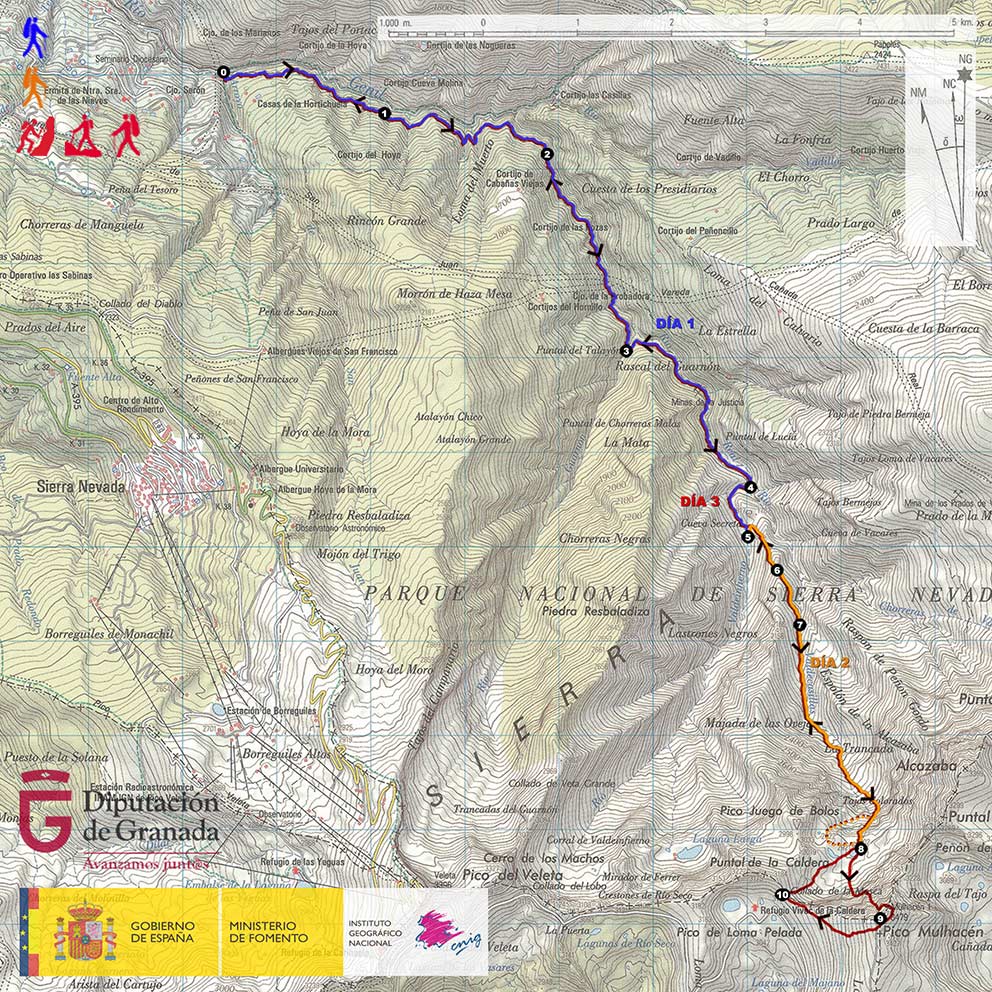
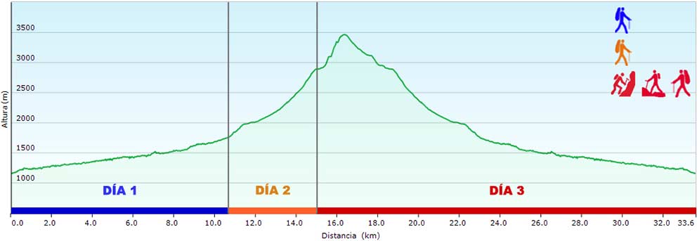

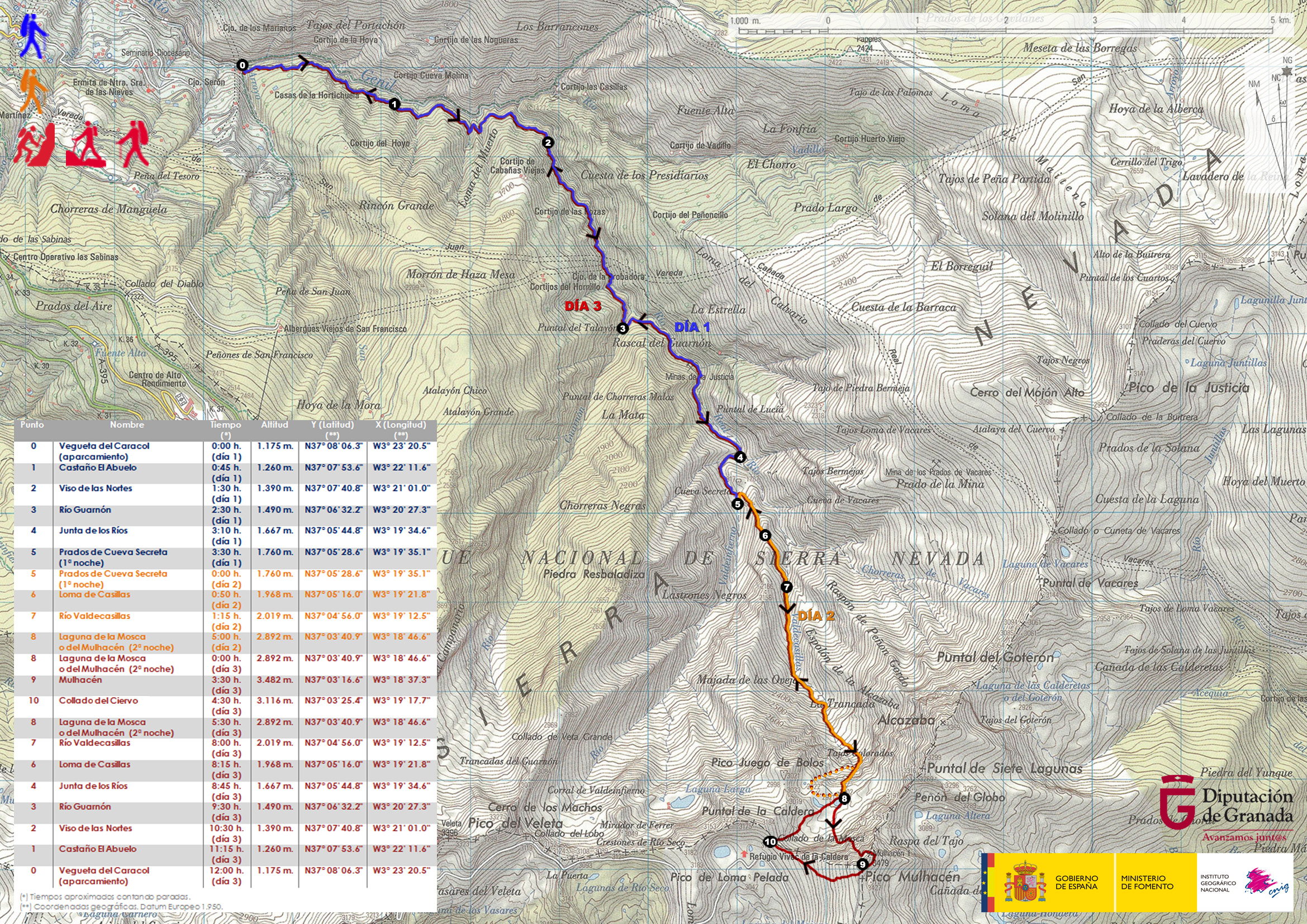
DAY 1: VEGUETA DEL CARACOL – CUEVA SECRETA
The path starts in the Vegueta del Caracol (point 0), where the Arroyo de San Juan stream flows into the Genil River, and where the Tramway of the Sierra used to arrive in the past. Just at the end of the disappeared route of the streetcar, we will find a wide esplanade where we can park our vehicle.
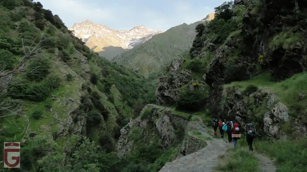
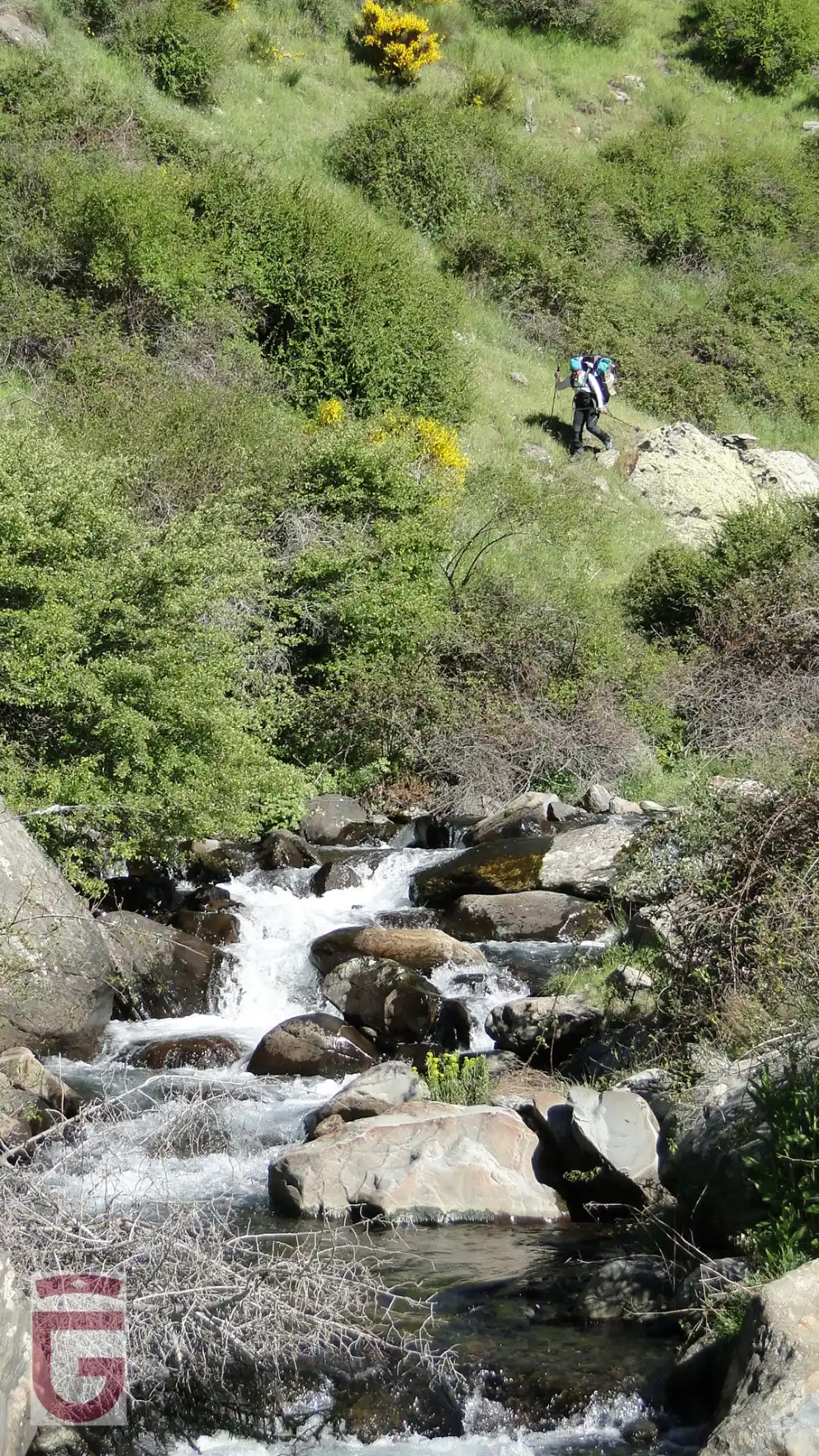
We will start the walk crossing the Genil River, thanks to a wooden bridge, and joining the Vereda de la Estrella.
The Vereda de la Estrella was opened in the 1960s on the left bank of the Genil River (orographically speaking) to facilitate the extraction of iron from the mines of La Probadora, La Estrella, and La Justicia, all located upstream.
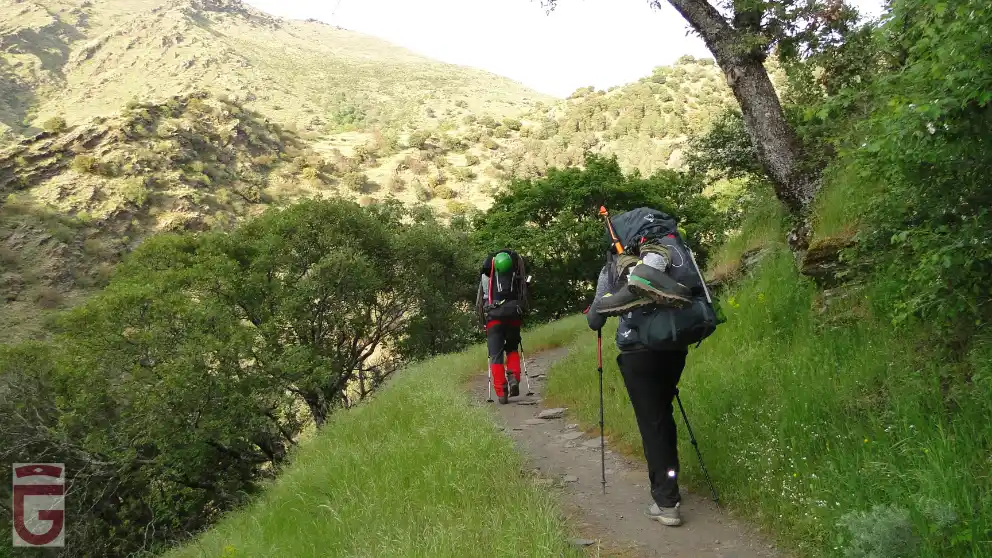
In this first section of the route, the Vereda de la Estrella runs along the Arrecife, a place where the valley slopes drop steeply towards the river. Shortly after, we will pass by the Castaño El Abuelo (point 1), whose great size and resistance we will admire.
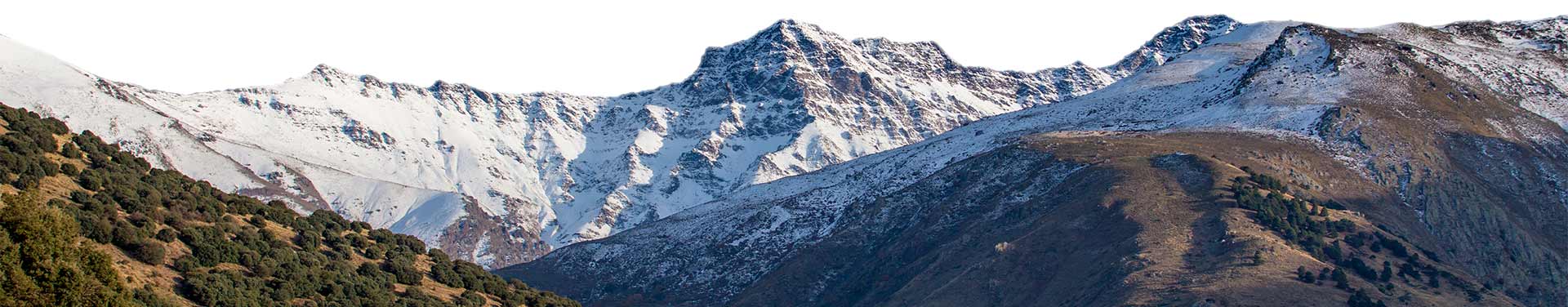
After approximately 1 hour of walking, after several twists and turns in which we will cross the ravines of Las Tormentas, Loma del Muerto and Cabañas Viejas, the trail will take us to the junction or fork where the Vadillo River joins the Genil River. A little further on, at the point where the valley of the Genil River turns decidedly south, we will find ourselves at the Curva del Viso, or Viso de las Nortes (point 2), a place from which we can admire for the first time the impressive, and still distant, north faces of the Alcazaba and Mulhacén.
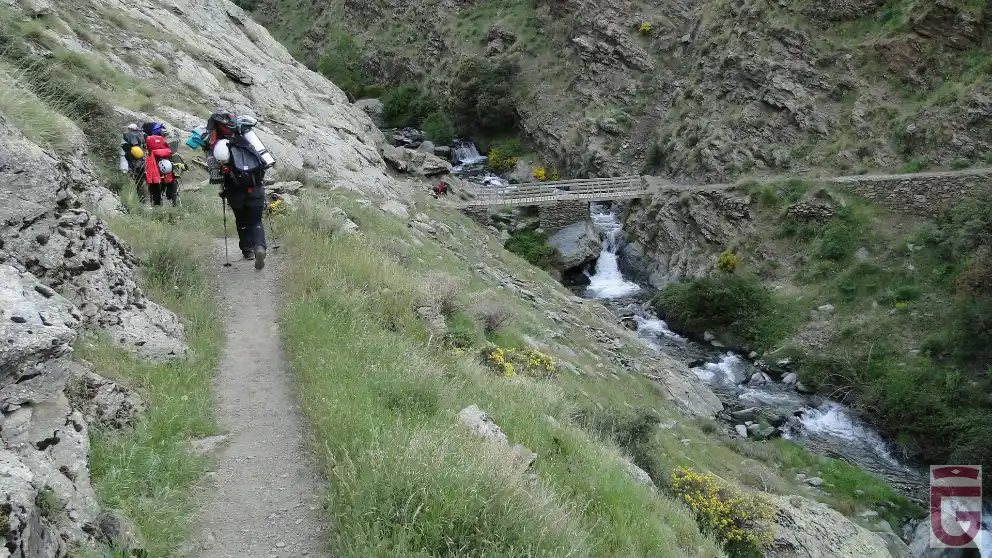
Continuing through the Vereda de la Estrella, whose dimensions are still those of a road, we will reach the Minas de la Probadora. From here the road becomes narrower and, soon, we arrive at the Minas de la Estrella. After crossing the ruins of this ancient settlement, the path we follow will take us across the bridge over the Guarnón River (point 3).
At the head of the Guarnón valley, we can see the north face of the Veleta.
Once we leave behind the Guarnón River, we will go around the base of the enormous Loma del Lánchar and we will contemplate, to our left, the Barranco del Aceral, whose waters fall into the Genil River in the form of a beautiful waterfall. Next, we will pass by the remains of the constructions of the Minas de la Justicia and we will arrive there where the rivers Valdecasillas and Valdeinfierno join to form the Genil River, the so-called Junta de los Ríos (point 4).
From this place, we will cross the Majada del Real to, following the course of the Valdeinfierno River, reach the area known as Cueva Secreta (Secret Cave). We will cross the river over a small bridge and, after a short walk along the left bank of the river (in the direction of travel), we will reach a large terraced area where we will spend the night (point 5).
DAY 2: CUEVA SECRETA-LAGUNA DE LA MOSCA
The next morning we will try to get up as early as possible in order to reach the snowy areas at a prudent time, taking full advantage of all that the night thaw can give us.
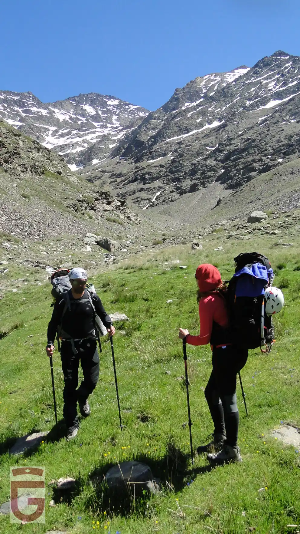
We will depart from our place of sleep (point 5) to, immediately, put us on the Fold of the Stick, a spacious landing, located on the Hill of Boxes. We will continue to climb up the western slope of the Hill of Boxes, whose opposite side we go through a pathway. Once crossed the Hill of Boxes (item 6)we will have penetrated in the domains of Valdecasillas, valley through the bottom of which flows the river of the same name.
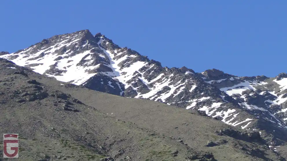
Above, to our left, we will contemplate the Puntal and the Prados de Vacares. Below, in the same direction, we will observe how the Arroyo de Vacares forms a beautiful "ponytail" before pouring its waters into the Valdecasillas River. In front, we will contemplate the entire Espolón de la Alcazaba, with its approximate 1,500 meters of unevenness.
The path we follow will lead us halfway up the slope towards the right bank of the Valdecasillas River (in the direction of the march), bank next to which we will continue ascending (point 7).
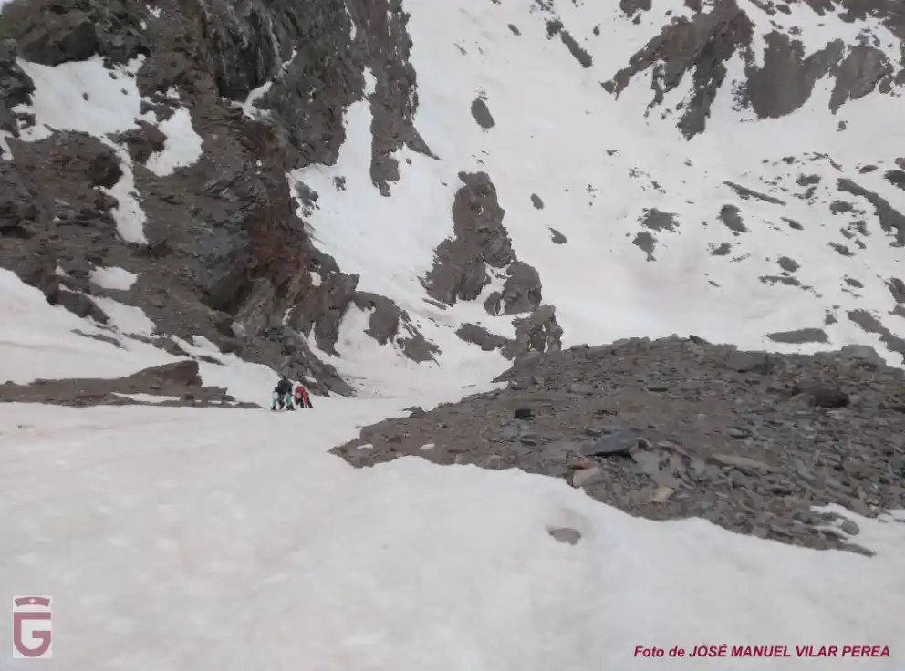
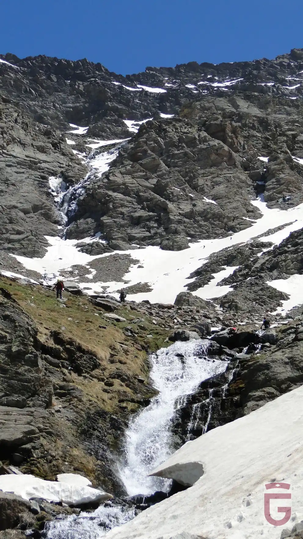
In our ascent through the right margin of the river, we will alternate the gradual ascent with the overcoming of two ledges, the last of them located at 2,500 meters, where the waters of the river form a cascade. Once we overcome this last ledge, a wide valley will open up before us, which is delimited to the east by the Alcazaba, to the south, by the Chorreras de la Mosca, and, to the west, by the Pico Juego de Bolos. We will cross to the left side of the river (always in the direction of the march) and we will begin to go up the watercourse towards the Chorreras de la Mosca, name given to the waterfalls formed by the Valdecasillas River just after its source. We will cross the river again and go up the slope, always with a tendency to the right, ending up overcoming the rocky ledge through which the Chorreras de la Mosca waterfalls fall.
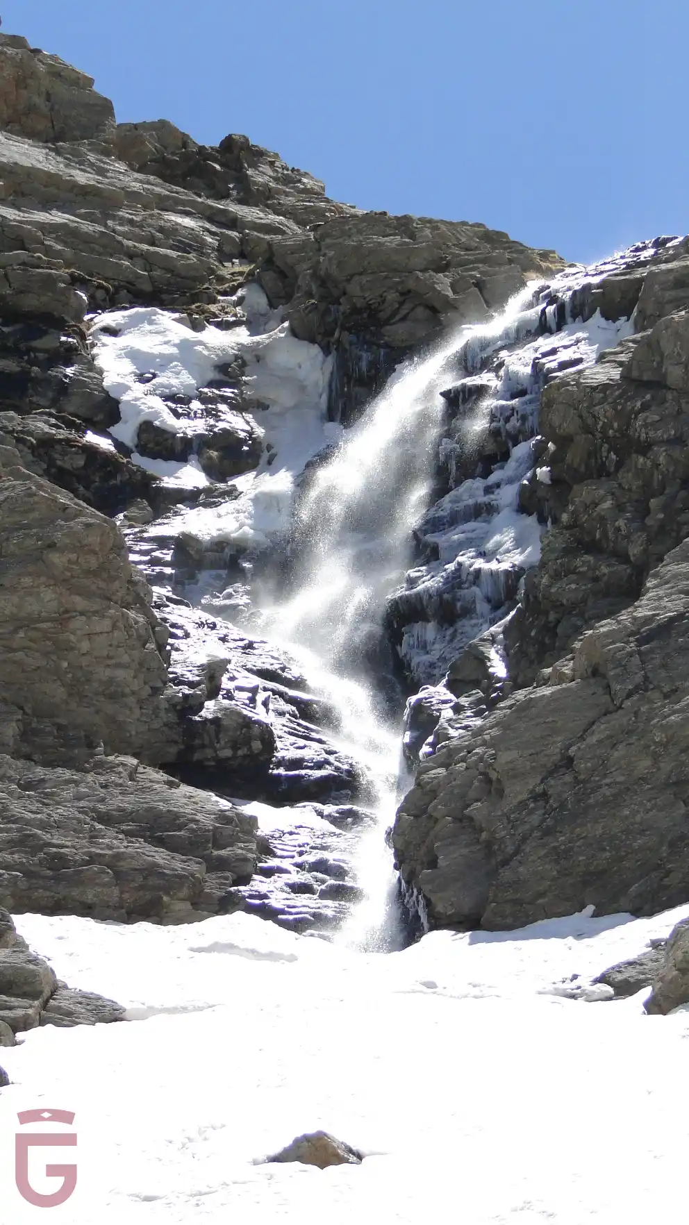

below the Chorreras de la Mosca
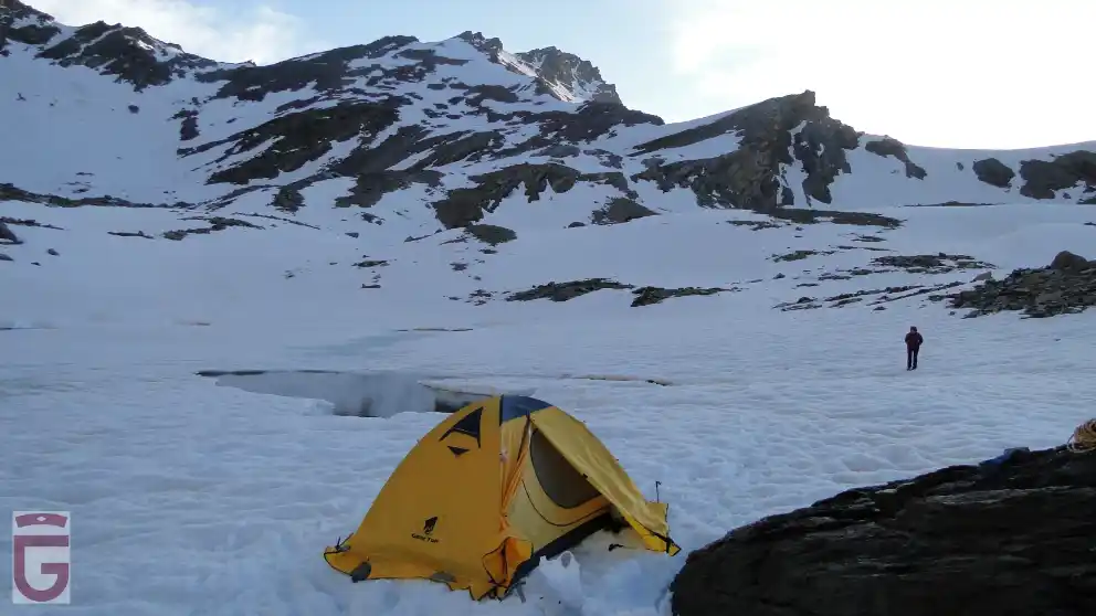
Once we have passed the last ledge, we will see the large pit in which the Laguna de la Mosca (Mosca Lagoon) is located (point 8), right at the foot of the impressive north face of Mulhacén. We will arrive at Laguna de la Mosca around noon, being important to rest during the afternoon, and go to bed early, in order to get up early the next day.
DAY 3: CENTRAL CORRIDOR OF THE NORTH FACE OF THE MULHACEN AND BACK
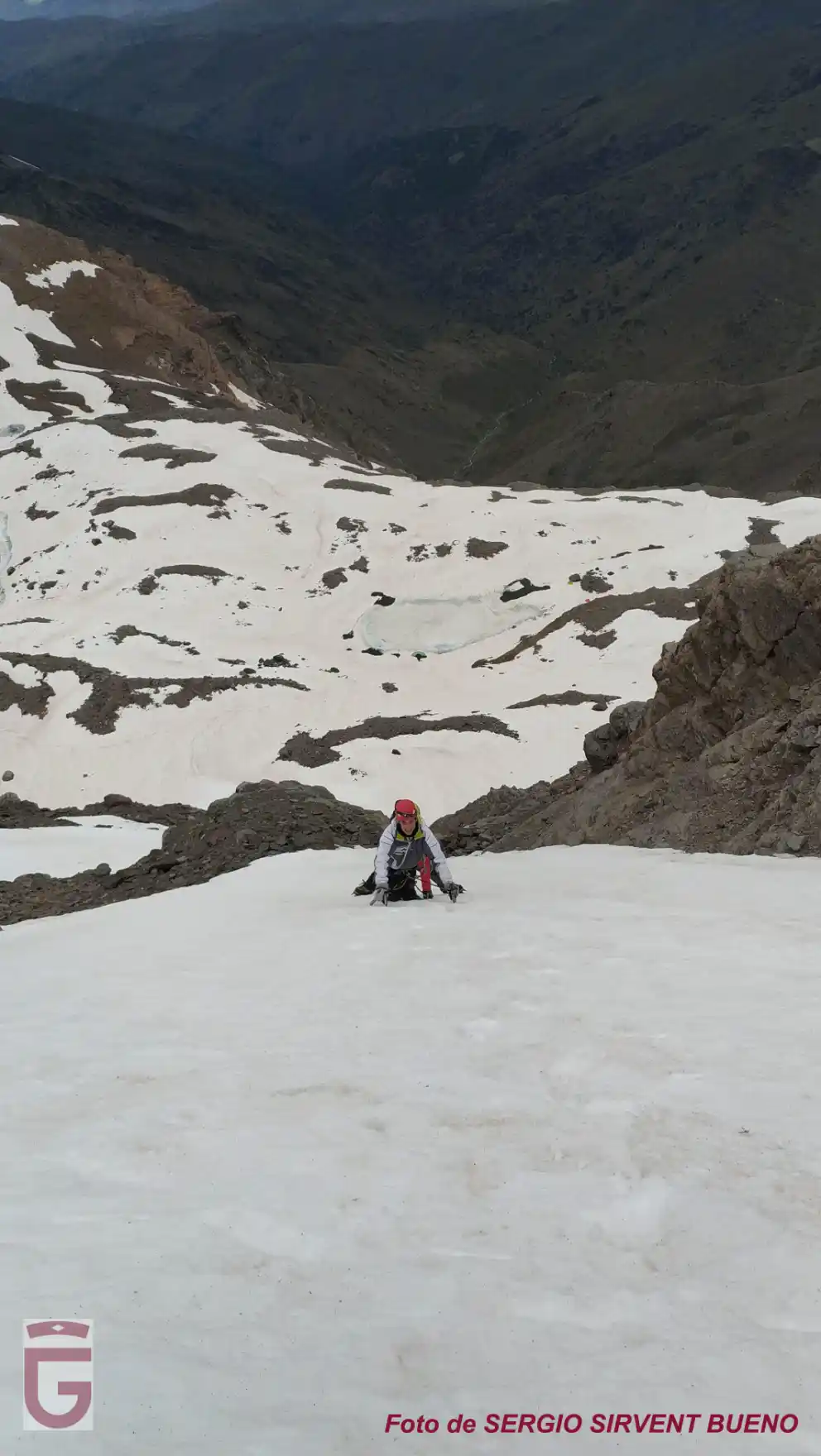
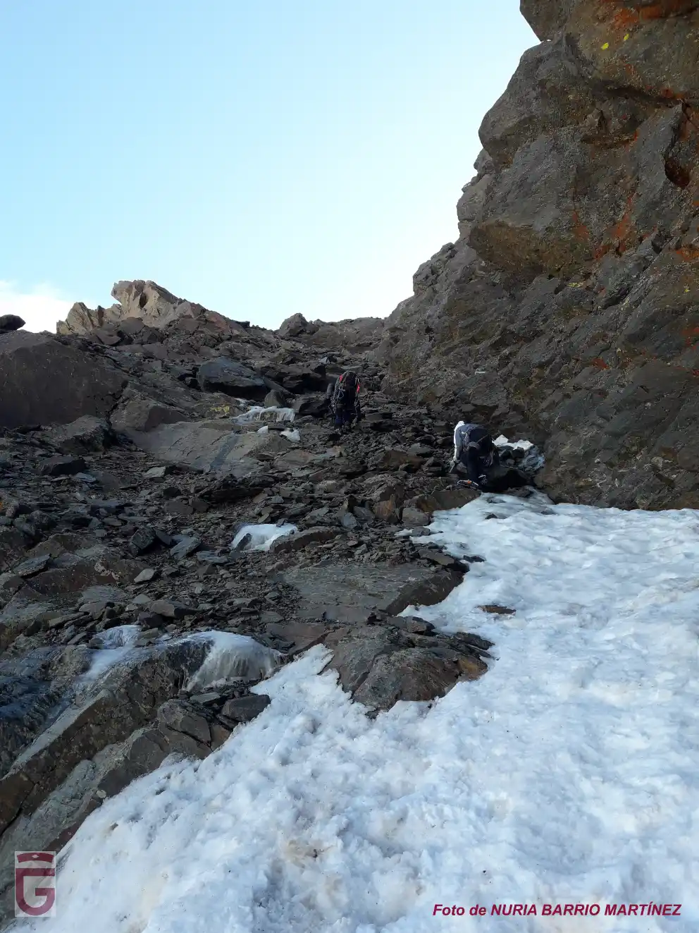
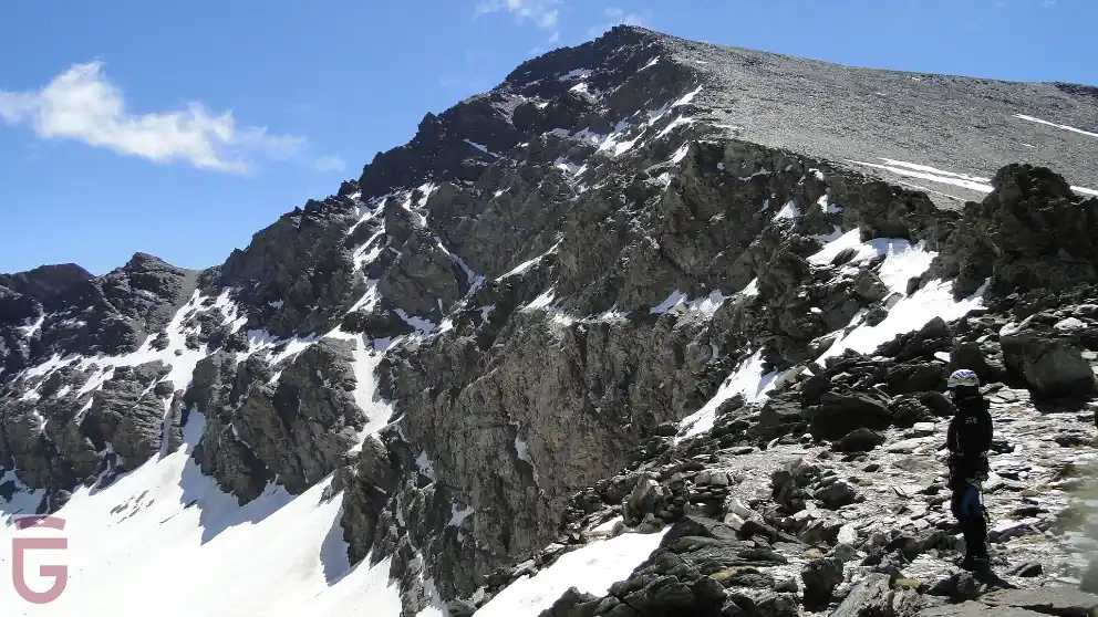
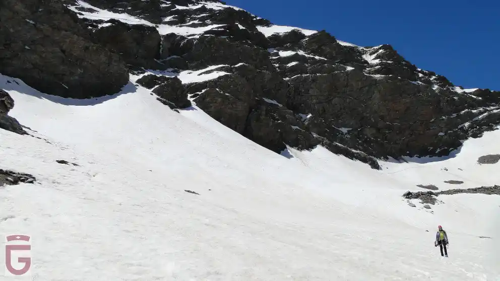
On the third day, we will depart from our second overnight stay (point 8) at 07:00 h. Previously we will have hidden the non-essential material, in order to pick it up on the way back. We will start going up the slope towards the large dejection cone that is located slightly to the right of the center of the north face of Mulhacén.
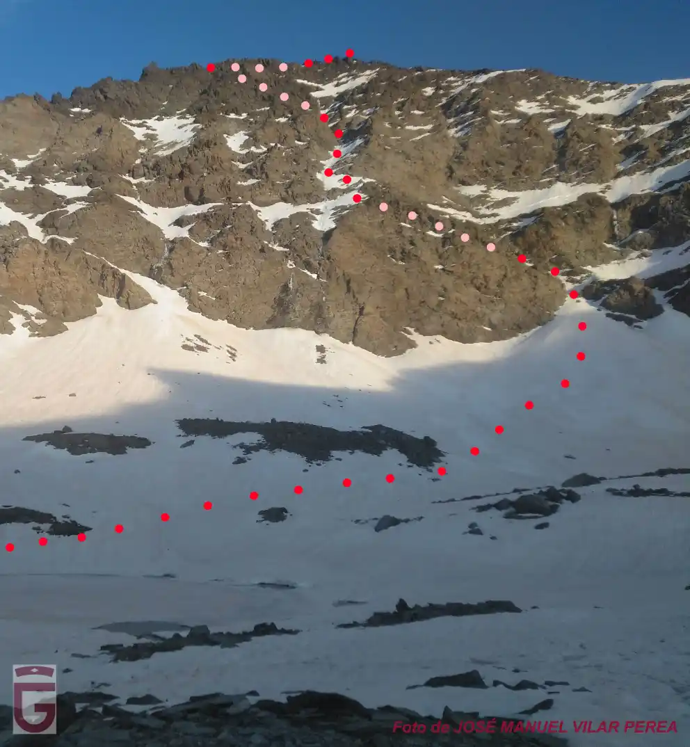
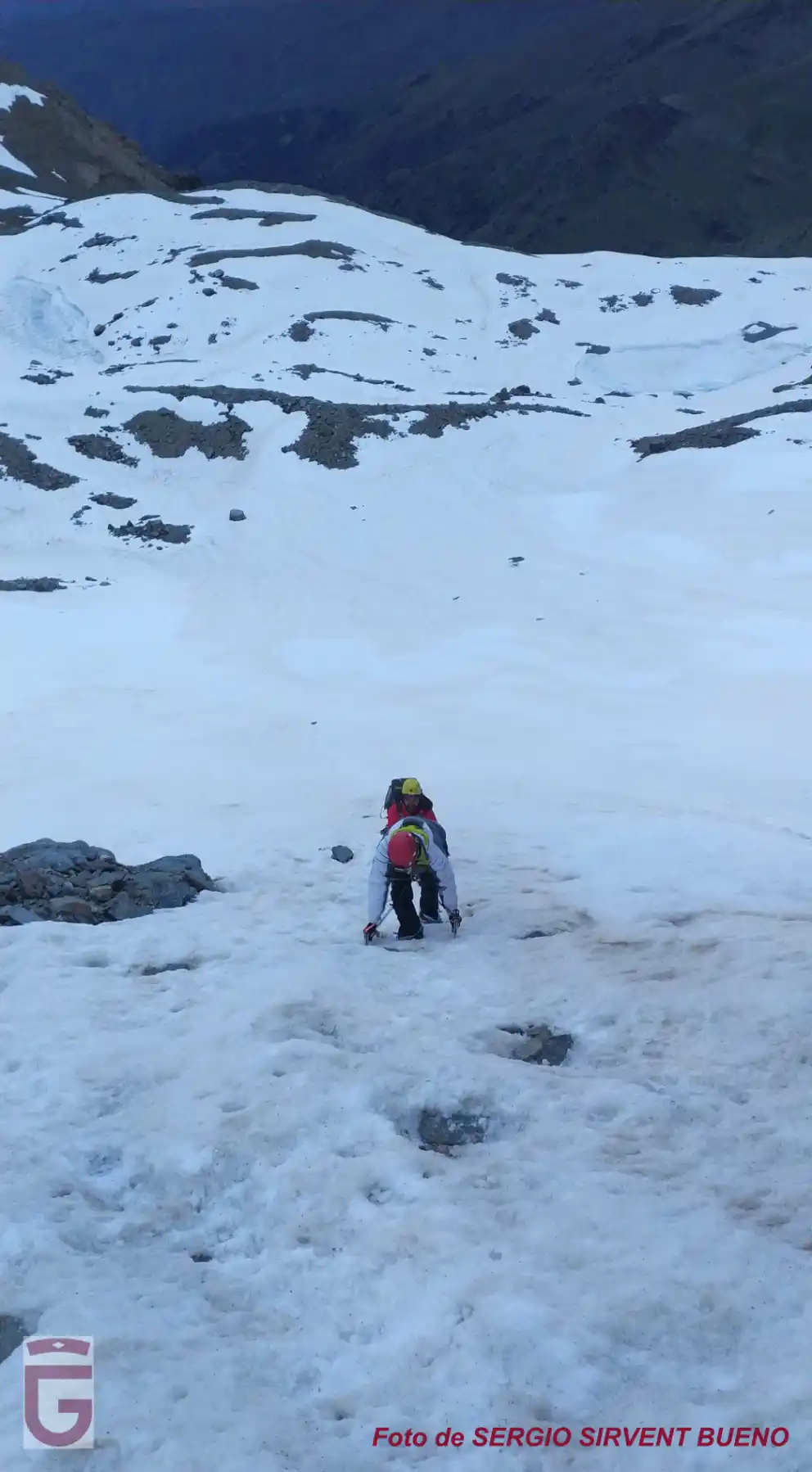
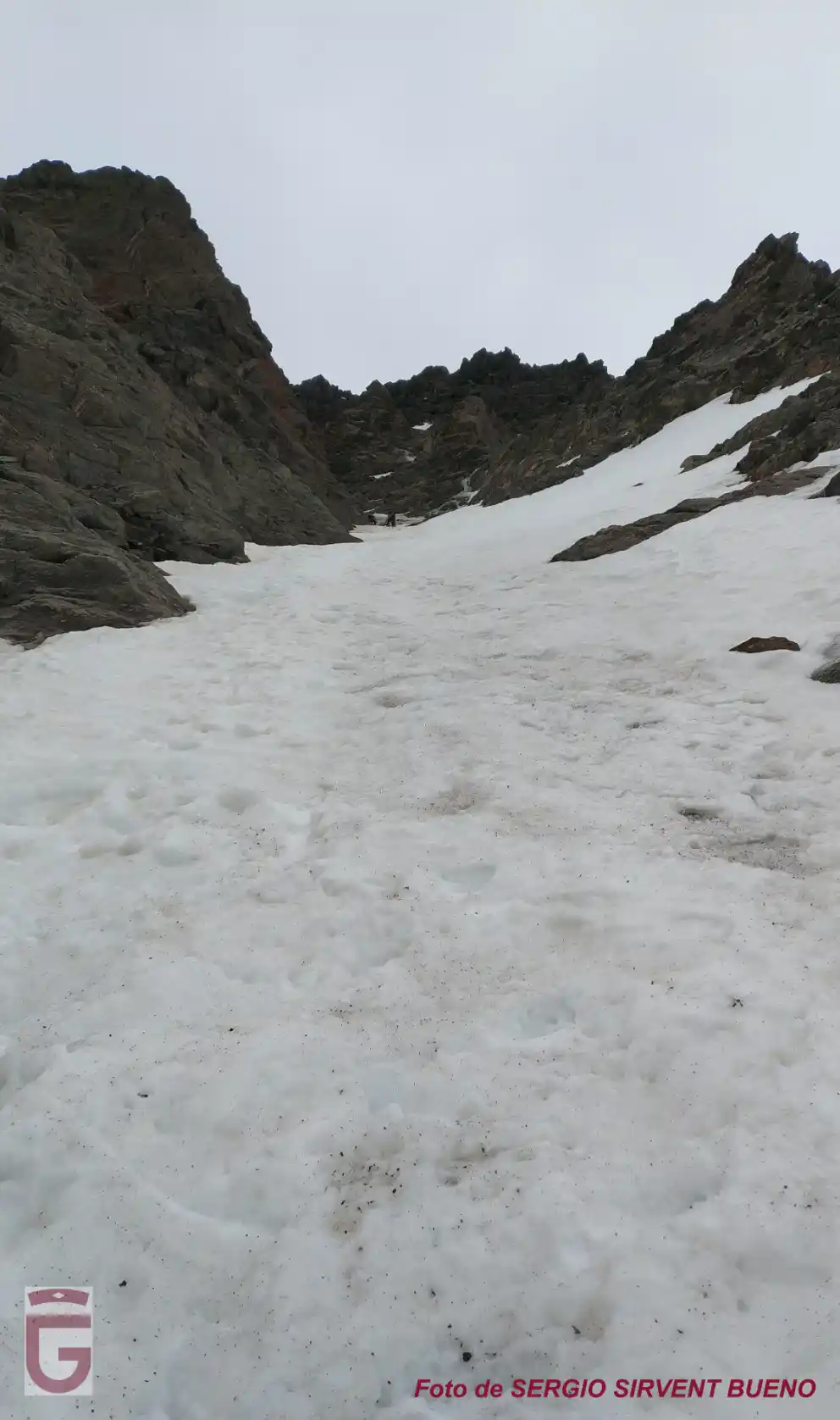
Once we have passed the upper narrowing of the dejection cone, we will turn left and begin to climb through a wide cornice, which has about 40 degrees of inclination and ends in the Vasar del Mulhacén.
once the narrowing of the ejection cone has been overcome
The Vasar is a cornice or vira that crosses horizontally the north face of Mulhacén and is located approximately one third of the total height of the wall. Following the Vasar a few meters, we will cross a spur, and, immediately, we will see how the Central Corridor opens to our right.
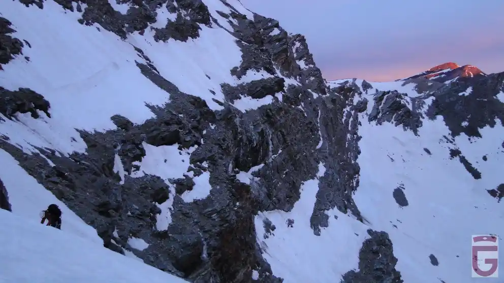
The Cerro de los Machos and the Picacho del Veleta lit by the sunrise
The Puntal de la Caldera stands out to our back, in the first term
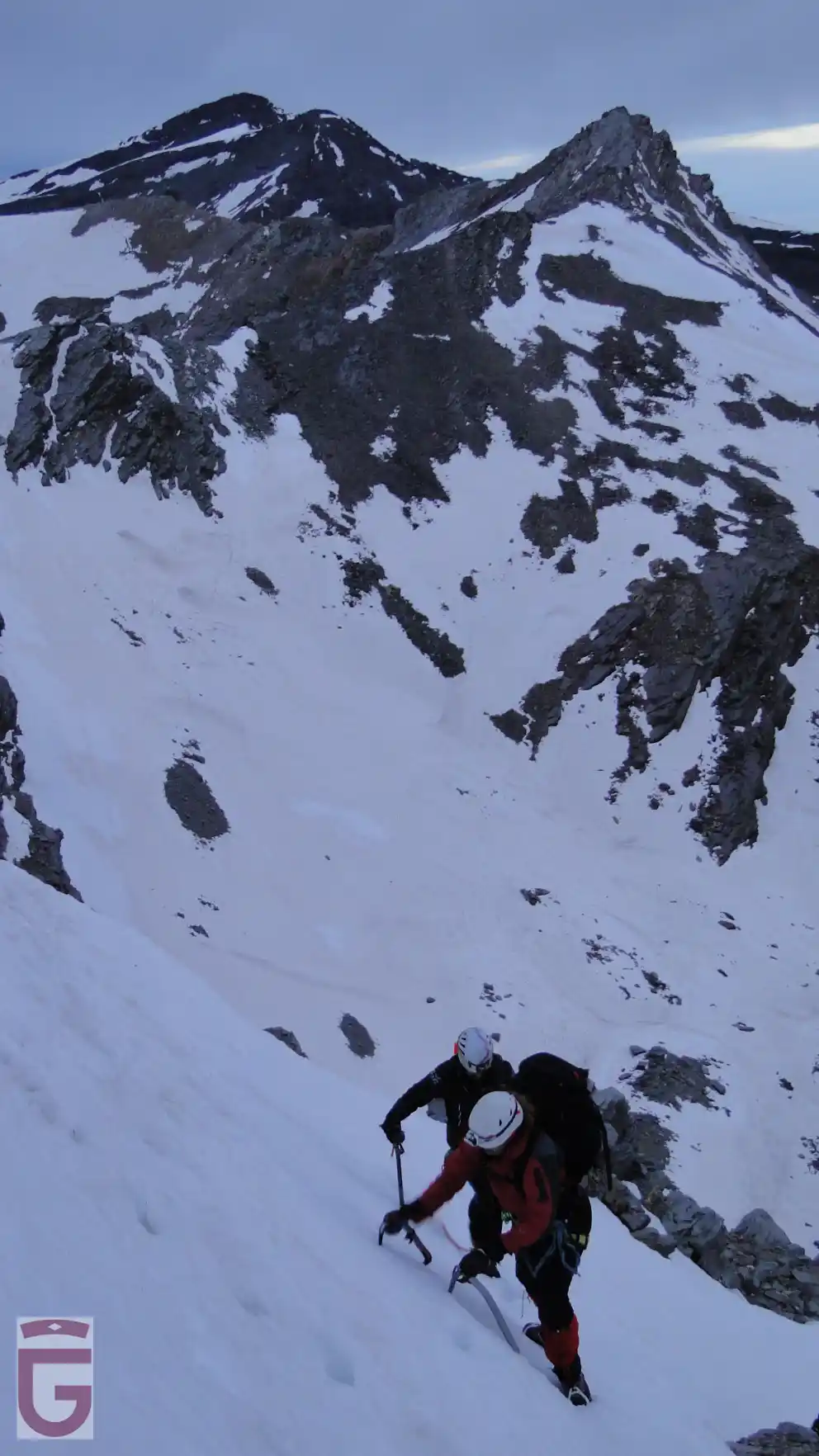
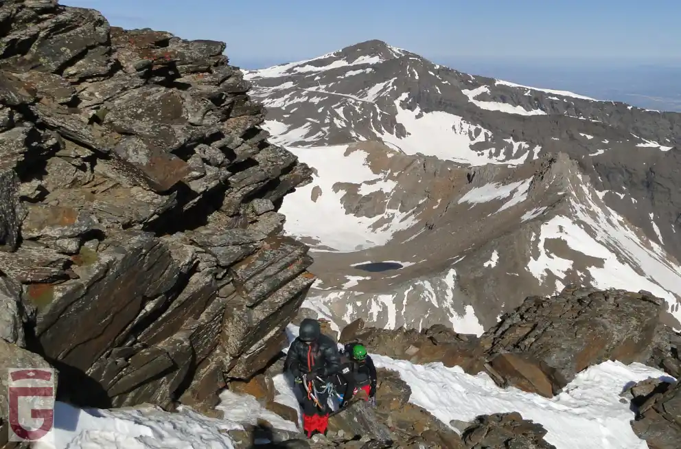
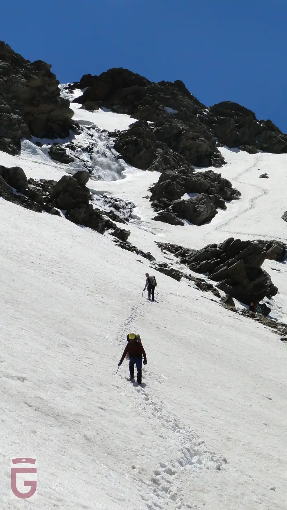
After climbing about 200 meters of corridor with slopes between 45 and 50 degrees, we will probably come across an icy section of about 10-15 meters in length that we will be forced to secure.
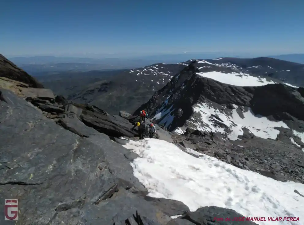
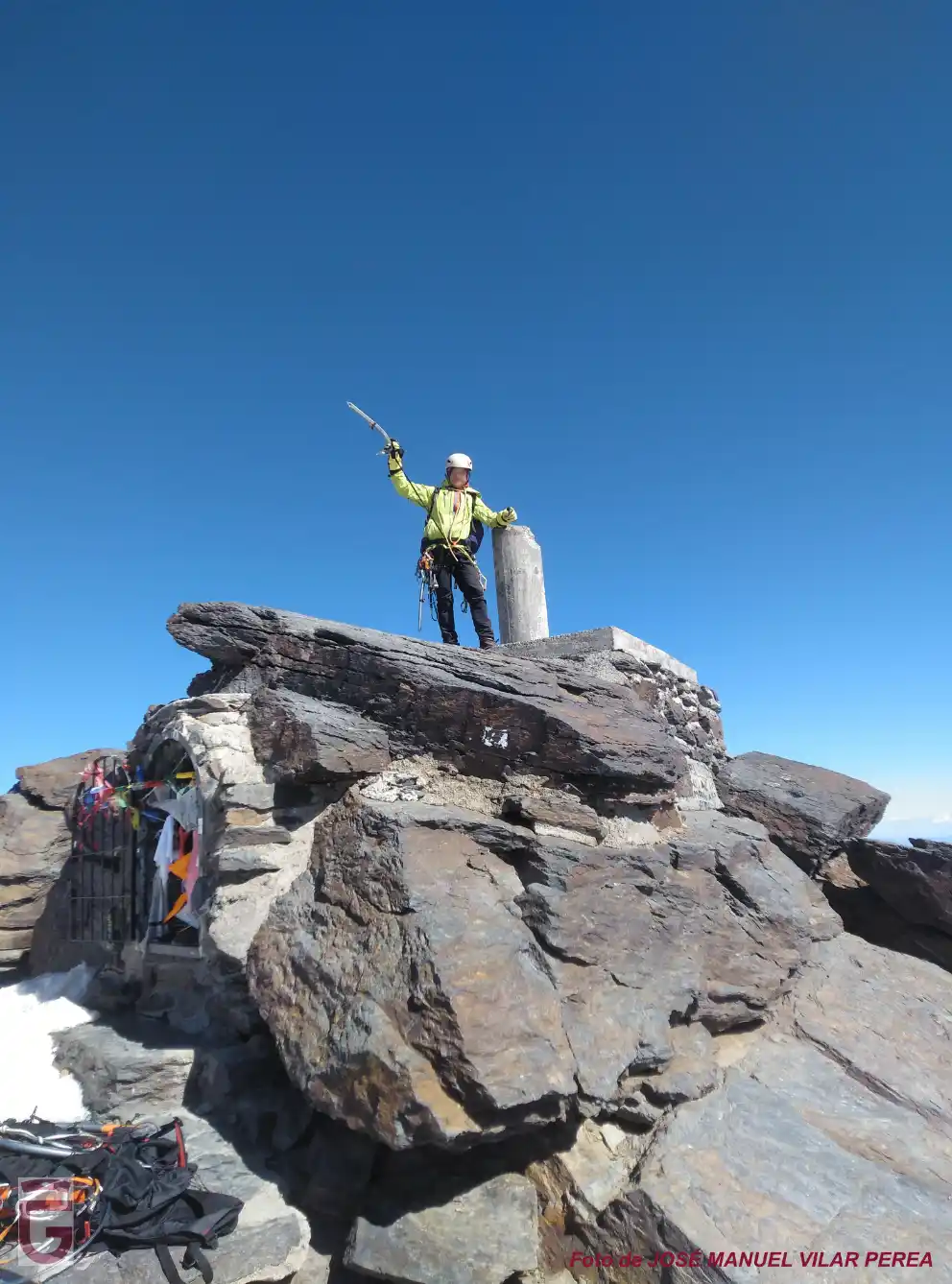
After passing this segment, we will continue moving about 100 meters further, either because of snow, until you run into the rocky hillock which closes the upper end of the corridor. Leave the corridor, following the pretty vira inclined towards our left and which form part of the Pathway Lorente-Monleón. The vira us out to the snowfields above the north side, which we will cross to the left, avoiding in this way the band rocky top and exiting at the end of the Ridge to the Northeast. After driving a short stretch of the ridge following the way that it is more easy, we will come to the summit of Mulhacén (point 9).
The descent from the Mulhacén will be done following the normal route, which runs along the west face. We should not relax too much because, although it has a moderate slope, the west face can be icy. We will head toward the Collado del Ciervo (point 10), and, from there, we will descend to the Laguna de la Mosca (point 8).
Once in the lagoon, we will rest briefly, and after collecting all the material, we will begin to descend. We should not delay our return too long because the evening temperatures could soften the snow too much, and our passage below the Chorreras de la Mosca, crossing the river, could be quite compromised.
Once we have passed the Chorreras, we will only have to continue descending, retracing the path we took on the way out.
The return to the Vegueta del Caracol (point 0) will seem endless due to the accumulated fatigue, however, the feeling of having made a great climb will more than compensate our suffering.
